Involve people in designing and planning public places

Involve people in designing and planning public places

Placemaking is a term used to describe how city spaces can be imagined and planned by involving the community. Placemaking as a technical term refers to a collaborative process to maximise the value of spaces for the community. It facilitates creative patterns of use and is aimed at strengthening the connection between people and places. It propounds that the happiness and wellbeing of people is central to the success of a space. It could be an idea like Raahgiri, redesigning a plaza, a children’s park, a food street, market, mela etc. but the key element is to ensure community participation.

Read More

Interview with Linda Pompa

1. What is your relation to Jane Jacobs Walks?

We have hosted a walk for the last three years.

2. Why were you interested in hosting a walk in New Orleans?

We wanted New Orleans to be part of the larger effort, and felt we had a good story to tell about our particular neighborhood.

3. What do you hope people gain from attending this walk?

We wanted people to learn about the history of the neighborhood, and how revitalization efforts over the last several years align with Jane Jacobs' perspective and approach. We wanted people to appreciate a neighborhood that most don't know about, and simply look at as "dangerous."

4. What are your goals when you host a Jane Jacobs Walk for the participants?

We want to inform about the little-known history, and promote the progress that the neighborhood has made. We want to expose people to assets and attractions they may not have known about.

5. What are your hopes for the future of New Orleans with regards to Jane Jacobs Walks?

We would like to continue hosting a walk, and would be happy to collaborate with others who want to do walks in other parts of New Orleans.

6. Is there anything else you want to add?

We really enjoy doing this, and so do the participants! 

Why Dallas Lags Behind the New Urban Renaissance

Originally published at https://www.dmagazine.com/frontburner/2018/06/why-dallas-lags-behind-the-new-urban-renaissance/ by Peter Simek

Originally published at https://www.dmagazine.com/frontburner/2018/06/why-dallas-lags-behind-the-new-urban-renaissance/ by Peter Simek

This is the second in a two-part series in conjunction with D Magazine’s urbanism special issue that looks at how thinking around urban planning has created the city Dallas is today. The first can be found here.

By the mid-twentieth century, observers of the rapid changes that were unfolding in American cities began to recognize that the places that were being created did not reflect the ideals promised by the authors of the City Beautiful, Garden City, and Radiant City visions. For all their virtues and flaws, these imaginations of city life were supposed to enrich the quality of life of its inhabitants, allow greater access to nature and leisure, and introduce a higher standard of aesthetic pleasure in urban form. But many 20th century “urban renewal” programs only created urban blight, transforming cities that were once full of life into empty, dull, and dangerous places.

One of the most outspoken critics of “urban renewal” was Jane Jacobs, a writer and activist who, after helping defeat a planned highway project that would have demolished her neighborhood in New York’s West Village, published a landmark treatise on city life called The Death and Life of Great American Cities (1961). Drawing on close observations on how life in her neighborhood functioned, Jacobs argued that cities thrived when their communities were home to many uses that were shared by people who sought in them a variety of opportunities and services. Jacobs embraced the messy intermingling of people, places, and economic functions that modern planners had spent a half-century attempting to root-out. Crucially, Jacobs understood that the mid-century deterioration of cities was no accident.

“There is nothing economically or socially inevitable about either the decay of old cities or the fresh minted decadence of the new unurban urbanization,” Jacobs wrote. “On the contrary, no other aspect of our economy and society has been more purposefully manipulated for a full quarter of a century to achieve precisely what we are getting. Extraordinary governmental financial incentives have been required to achieve this degree of monotony, sterility, and vulgarity. Decades of preaching, writing, and exhorting by experts have gone into convincing us and our legislators that mush like this must be good for us, as long it comes bedded with grass.”

Jacobs was not alone. Other urban observers, such as writer William Whyte and planner Kevin Lynch, began conducting careful observations of day-to-day life in vibrant city neighborhoods and came to many of the same conclusions. But by the time that these critics began sounding the alarm, this new approach to city planning had already been enshrined in many codes, policies, governmental programs, and the attitudes and assumptions of city, regional, and federal planners.

In the 1970s and 1980s, riots, fires, surmounting crime, deepening segregation, expanding poverty, and general urban dereliction came to define the very loci of supposed “urban renewal” projects. Planners and bureaucrats saw this not as a failure of policy, but as its insufficient implementation.

Sun Belt cities proved effective at hiding the costs of the success of “unurban urbanization,” and in the 1970s and 1980s, Dallas emerged as a model of the kind of economic success government-subsidized suburban sprawl could generate. However, Dallas’ model of growth created its own problems. While residents migrated into the region’s northern suburbs in pursuit of bigger homes and better educational opportunities, those who remained behind struggled with degrading schools, rising crime, and entrenching poverty.

By the late 20th century, this pattern of expiration and neglect began to migrate outside of Dallas and into its inner-ring suburbs. The communities that were the first beneficiaries of decentralization were eclipsed by newer and more attractive suburbs.

The Counterproductive Decentralized City

This cycle is one of the peculiar, paradoxical characteristics of the decentralized city. On the one hand, the decentralized city seems to treat neighborhoods like the consumer economy treats commodified goods. Neighborhoods have a shelf-life. As they age and their initial appeal fades, they are discarded in favor of a newer “neighborhood-products.” Unlike neighborhoods in centralized cities, which become more desirable as they mature and stabilize over time, in the decentralized city, older neighborhoods are discarded as a kind of urban consumer waste.


Wheel Cool: The Uptown trolley was resurrected as a cute diversion for tourists but has now become a legitimate transportation option for residents who commute to downtown.

Wheel Cool: The Uptown trolley was resurrected as a cute diversion for tourists but has now become a legitimate transportation option for residents who commute to downtown.

But in other ways, the decentralized city doesn’t appear to follow the logic of a consumer market at all. As the tremendous rebound of urban real estate values in walkable cities like New York and San Francisco attest, the kinds of neighborhoods Jacobs, Whyte, Lynch, and others championed are highly desirable to many people. But if there is consumer demand for these kinds of communities, why haven’t developers met that demand by building new urban neighborhoods?

Over the past two decades in Dallas-Fort Worth, some developers have attempted to build more walkable, urban neighborhoods. But too often, developers seeking to build new urban neighborhoods are met with the complicated tangle of codes, policies, and financial regulations developed in the 20th century to support the growth of sprawl. These bureaucratic and political rules and assumptions have been sublimated into the inner-logic and administration of the decentralized city, making the production of a single, monolithic urban form the normative operative procedure of regional governance. Put simply, myriad administrative obstacles make it all but impossible to build good urban neighborhoods in Dallas.

And so today we have a situation in which, in the fourth largest metropolitan region in the country, there are hardly any neighborhoods that function like the kind of urban neighborhoods Jacobs and her cohorts championed. In fact, if you have lived in Dallas-Fort Worth your entire life and never left the region, you would have no real frame of reference to understand what kind of environment these writers evoke when they use the word “city.”

But most of us know what it feels like to be in these cities because they are the places we seek out in our travels. They are cities in which streets are filled with people; cities that can be explored and discovered by foot; cities that foster interaction, not separation; variation, not monotony; human connection and community, not dissociation and isolation.

And it is that disconnect between the cities we seek out and the urban region Dallas-Fort Worth has become that should provoke the greatest consternation among regional leaders. Despite Dallas’ long-held dreams of civic grandeur, the region has evolved into a place defined and entrapped by what architect and urban planner Andrés Duany describes as “the gravity of mediocrity.”

The Rebirth of the Great 21st Century American City

After witnessing the urban devastation of the latter half of the 20th century, architects, planners, politicians, and municipal bureaucrats revisited the writings of Jacobs and the other critics of urban renewal and began to rethink assumptions about what successful urban neighborhoods look like. At the same time, as the century drew to a close, new images of American life began reshaping public opinion, in part through television shows like Seinfeld and Friends. The allure of the suburban utopia was replaced in the popular imagination with idealized feelings of possibility and energy conveyed by images of life in urban neighborhoods. And the cities that still possessed these kinds of older, messier, multi-functional, pedestrian-driven, human scaled places began to thrive again.

But there was a problem.

Twentieth-century urban renewal had left many cities with few well-functioning urban neighborhoods, and in regions like Dallas-Fort Worth, hardly any at all. A rise in demand, coupled with limited supply, drove the real estate values of attractive urban neighborhoods through the roof. Along with increased financial speculation, the hyper-financialization of the real estate, and other pressures of an increasingly globalized economy, urban neighborhoods in cities like New York and San Francisco became economically unattainable for all but a few. Urban life, once associated with crime, drugs, and dereliction, emerged as synonymous with economic elitism. Gentrification and the economically driven displacement of residents from established neighborhoods proved nearly as disruptive and destructive as urban renewal.

But just as the suburban sprawl is not a deterministic outcome of the invention of the automobile, gentrification is not a necessary result of the desirability of urban neighborhoods. Rather, it is partly a symptom of a political and economic system that has largely eliminated choice from the neighborhood market. Even though studies have shown that upwards of 60 percent of Americans would like to live in neighborhoods that are walkable, where basic services are accessible without the use of a car, and which foster a greater sense of community, only a small percentage of the built environment in the United States provide this kind of urban experience.

Planners and developers hoping to reintroduce desirable urban spaces found it easier to accomplish in some cities more than others. The Danish architect and urban designer Jan Gehl helped to radically transform Copenhagen into a hyper desirable bike-and-pedestrian-centric urban playland in a little over a decade by redesigning streets and public ways that supported pedestrian and bicycle use. In New York, projects like the renovation of Bryant Park demonstrated how applying Jacobs’ and Whyte’s principals of scale and dynamic, cross-pollinating human interactions could turn what was once a crime and drug ridden no man’s land into one of the most beloved and well-used parks in the country.

But too often, planners seeking to return cities to human-oriented scale ran into opposition from entrenched bureaucrats, politicians, and stakeholders alike. The principles of the 20th century urban experiment had become established dogma, and many held tight to a belief that easily accessible free parking, fast-moving highways and streets, segregated commercial and residential districts, and limited density were essential ingredients to urban success. Zoning, building, traffic codes, and other policies restricted the kinds of building forms, densities, and streets designs developers and cities could provide. It became clear that, in order to change urban form, the rules of urban governance would have to be rewritten.

One such effort came in 1993, when a handful of architects and planners came together to form the Congress for the New Urbanism, which made one of its central prerogatives to draft a new building code that would simply allow cities to create the kinds of urban places people wanted but cities no longer had. The “Smart Code,” as the Congress for the New Urbanism called, was not a set of aesthetic ideals. Instead, it attempted to distill Jacobs’ and Whyte’s observations about how cities functioned into the language of governmental code.

It emphasized attributes like “walkability,” defined as having access to shops, restaurants, workplaces, and services within a 10-minute stroll from one’s front door. Neighborhoods were to be connected by a clearly defined hierarchy of narrow streets, boulevards, and alleys, all accented with high-quality pedestrian amenities.

A New Vision for the “Multi-Nodal’ Metropolitan Region

As Jacobs argued, good streets incorporate a mix of uses and diversity of functions, with blocks that contained shops, offices, apartment, and homes, and districts that included housing suitable for a variety of ages, income levels, cultures, and races.

Continue carousing on Lower Greenville. Photo by Scott Womack.

Continue carousing on Lower Greenville. Photo by Scott Womack.

Quality architecture is important to the success of urban neighborhoods but it shouldn’t be employed to justify the creation of largescale, monolithic superblock developments or uniform, monofunctional districts. Rather, buildings should offer a range of styles and prices, be situated in close proximity to each other, and older structures should be preserved alongside more contemporary forms. Density is vital to allow for walkability and economic vitality, but the planning of neighborhoods, districts, and towns should also carefully consider their overall structure. Highest densities are encouraged toward the center, with the entire district defined by an overall range of densities, ample public space, and discernable edges.

These principles of urban neighborhoods are not necessarily reserved for urban centers alone. Heavy government subsidization of sprawling super regions has created metropolitan areas that are expensive to maintain, inefficiently distribute economic opportunity, rely exclusively on automotive transportation, and contribute to environmental degradation and pollution. One way to overcome some of these shortcomings is to plan a greater diversity of mixed-density, mixed-use neighborhoods throughout the sprawl of massive super regions—a “multi-nodal” metropolitan region, a region defined by an interconnected network of dense urban areas.

City centers like Dallas, as well as many suburban towns and cities, could take advantage of the desirability and enhancing qualities of urban neighborhoods by reconfiguring their layout around clusters of urbanity that sit amid the wider expanse of suburb and exurban communities.

It is a vision of a region that would develop into a multi-nodal network of urban, suburban, and ‘edge’ communities, a decentralized city that is not defined and determined by a monolithic sprawl but is home to a multiplicity of smaller urban centers, each of which enhanced by the possibilities of strengthened community, stabilized economic value, and enhanced environmental sustainability. We have already begun to see what these new successful cities will look like: they are the places that reconnect with the fundamental qualities and efficiencies that are intrinsic to dense urban communities.

For 5,000 years, limitations in transportation and communication retrained the geographical shape and scope of cities. Today, technology has advanced to the point where human societies and economies can transcend most geographical limitations. The railroad and car began this process by accelerating mobility. Continuing advancements in communication networks, automated transport, and mediated and artificial intelligence will only expand the capacity to imagine new forms of urbanized society. In light of this, the urban experiments – and failures – of 20th century should provide a warning. The best cities are not designed by prioritizing the possibilities of technology, but rather by responding to human needs.

Today, urban planners and policy shapers who are inspired by Jacobs and her ilk are attempting to accomplish something that has never been attempted in human history: they are trying to shape urban environments that forgo the possibilities of technological potential in favor of focusing on more humanistic design considerations. Here too the urban experiments of the 20th century offer a lesson. The rapid upheaval in the geography of urban space was brought about by a wholesale rearranging of urban polices. The reversal of this system of development could be accomplished by a similar broad-based application of new ideas and principles.

Invermere's First Jane Jacobs Walk

Originally published at https://www.columbiavalleypioneer.com/news/janes-walk-rolls-into-invermere/ by Ryan Watmough

How easy is it for everyone to get to downtown Invermere? Is there a different experience for the very young to the very old? Or for the most active to those that are disabled? And how does it differ for locals and visitors?

To discuss those answers and opinions, Thursday June 21st, starting from outside the Invermere Public Library, everyone is invited to the Columbia Valley’s first Jane’s Walk in downtown Invermere.

From the organization’s website, janeswalk.org, Jane’s Walk is an annual festival of free, citizen-led walking conversations inspired by Jane Jacobs (1916-2006), who was a “writer, urbanist and activist who championed the voices of everyday people in neighbourhood planning and city-building.”

Jane’s Walk is a community-building approach that “uses citizen-led walking tours to make space for people to observe, reflect, share, question and re-imagine the places in which they live, work and play.”

These guided tour-style events encourage people to share stories about their neighbourhoods, discover unseen aspects of their communities, and use walking as a way to connect with their neighbours.

The collaborative presentation, with groups like Access the Valley, Columbia Valley Community Foundation, Columbia Valley Chamber of Commerce, Wildsight, District of Invermere, Cycling Without Age, and Columbia Valley Greenways Trails Alliance, and businesses, including Bicycle Works and Main Street Fun & Games, creates a natural theme of “Rolling into Town” and through downtown Invermere.

The two-hour event is intended to raise awareness and host knowledge-sharing around aspects of good accessible design; active transportation and supporting infrastructure; and the community economic development (CED) benefits of inclusive placemaking.

Participants will have a chance to discuss current placemaking and active transportation flow and learn about future plans for improvements.

Some improvements like StopGap ramps to get into businesses, beach wheelchairs and electric bicycles are already available, which improves Invermere’s accessibility.

Other services like trishaws, the Westside Legacy Trail, low-carbon transportation initiatives, and District of Invermere’s road and sidewalk plans are about to be implemented, which can have both inclusivity and economic spin-off effects, enabling both residents and visitors to spend more time and money in the community.

This 100-minute, 2.4 km walk – or “roll,” if you prefer – is an exceptional opportunity to discover more about Invermere’s past, learn about how it impacts inclusiveness now, and prioritize future opportunities to make it better.

The event will conclude at the Columbia Valley Centre lobby, where participants can provide feedback on what they learned, what they like, what they would like to see improved and who can be involved.

For more information, please visit the following link: Facebook event: Jane’s Walk Invermere – https://www.facebook.com/events/997517470414920/.

Local experts to lead walking tours of Fayetteville June 10 and 17

Originally posted at https://www.fayettevilleflyer.com/2018/06/05/local-experts-to-lead-walking-tours-of-fayetteville-june-10-and-17/ and written by Dustin Bartholomew. 

Originally posted at https://www.fayettevilleflyer.com/2018/06/05/local-experts-to-lead-walking-tours-of-fayetteville-june-10-and-17/ and written by Dustin Bartholomew. 

Do you like learning about Fayetteville and its history? Do you enjoy getting a little exercise every once in a while? Want to do both of those things at the same time?

If you nodded ‘yes’ three times just now, you’ll be excited to know about four ‘Jane’s Walk’ events coming up in Fayetteville, as part of Walton Arts Center’s Artosphere Festival over the next couple weeks.

The first one is set for 10 a.m. on Sunday, June 10 featuring the Urban History of Downtown Fayetteville, and lead by historian Charlie Alison. Alison will lead participants from the Lafayette Street Bride south to MartinLuther King, pointing out sites of interest along the way. Attendees will meet at Lafayette Street Bridge, between West and Gregg Avenues in Fayetteville.

Later that same day at 2 p.m., Watershed Conservation Resource Center executive director Sandi Formica will lead a tour of the Mullins Creek Restoration on the University of Arkansas Campus. During the tour, Formica will speak about techniques for restoring urban streams, causes of degradation, and how they can create wildlife habitats and protect our drinking water source. Attendees will meet at the corner of Leroy Pond Drive and S. Razorback Road.

At 3 p.m. on Sunday, Professor of Indigenous Studies and citizen of the Cherokee Nation Sean Teuton will lead a tour titled Walking Native Fayetteville. During the tour, Teuton will point out Trail of Tears camp sites, historical buildings, and significant items relating to the Native American history in Fayetteville. Attendees will meet at Fenix Fayetteville Gallery (16 W. Center Street in Fayetteville).

That following Sunday, June 17, local artist and photographer Sabine Schmidt will lead a tour titled Ways to Wander: Rediscovering Our City. The tour will meet at Fenix Fayetteville Gallery (16 W. Center Street) at 11 a.m., and Schmidt will lead attendees on a tour that asks, “What happens when we walk like strangers visiting Fayetteville for the first time?”

All of the walking tours are ‘Jane’s Walks,’ and part of Walton Arts Center’s annual Artosphere festival.

The events are named for writer and activist Jane Jacobs, known for her 1961 treatise The Death and Life of Great American Cities, who encouraged people to walk their neighborhoods in order to discover unseen aspects of their communities, and as a way to connect with neighbors. Jane’s Walk events now take place in hundreds of cities around the country.

All of the tours are free to attend and open to the public. Each one will travel less than a mile, and will be an hour or less in duration.

For a bit more information, visit waltonartscenter.org.

ON ACTIVATING MACARTHUR SQUARE: A SPACE THAT NEVER LIVED UP TO ITS PURPOSE

This article was originally published at http://www.milwaukeeindependent.com/featured/activating-macarthur-square-space-never-lived-purpose/ and was written by Dominic Inouye. 

This article was originally published at http://www.milwaukeeindependent.com/featured/activating-macarthur-square-space-never-lived-purpose/ and was written by Dominic Inouye. 

The first time my fitness group announced that we would be working out in a brand new space, MacArthur Square, I was not the only one who posted on Facebook, “Where?” GPS told me it was tucked in between the County Courthouse, the Milwaukee County Jail, the Safety Building, the Milwaukee Public Museum, and the police headquarters. But after I found parking on James Lovell Street, I had no idea how to get there.

I was introduced to the space by November Project (NP) Milwaukee, the fitness group I have been a member of for the past four years. An international movement of over 40 cities that began in Boston, NP uses the city as its gym, gathering every Wednesday morning, year-round at 6:26 a.m., to box jump onto park benches, Burpee along waterfronts, sprint up stairs and hills, and partner sit-up on downtown sidewalks.

In Milwaukee, our Wednesday meet-up is always at Mark di Suvero’s orange sculpture “The Calling” in O’Donnell Park, in the shadow of the new Northwestern Mutual Tower and within feet of the sunrise-drenched brise soleil. We gather in sunshine, rain, or snow. Our tribe, as we call it, also works out on Fridays, alternating between seventeen other locations: as far north as Atwater Beach, as far east as Bradford Beach, south to The Domes and west to Washington Park. Other favorite spots in between include Kadish Park, the Riverwalk at the Bronze Fonz, Lake Park Bistro, and MacArthur Square.

When I got out of my car that first day, there was no park in sight. However, I followed some of my shorts-clad tribe members as they sheepishly walked up an unmarked spiral ramp in the dark, hoping that it would lead to someplace called “MacArthur Square."

Almost six decades before my first encounter with MacArthur Square, urbanist activist Jane Jacobs wrote in her 1958 Fortune Classicarticle Downtown is for People about the myriad downtown projects emerging around the country, in San Francisco, New Orleans, Nashville.

While at first readers might be tricked into thinking she was an advocate of such developments, her rhetorical strategy packed a deadly punch: “They will be spacious, parklike, and uncrowded. They will feature long green vistas. They will be stable and symmetrical and orderly. They will be clean, impressive, and monumental. They will have all the attributes of a well-kept, dignified cemetery.”

Such a cemetery exists in the heart of downtown, but I would not call it “well-kept” or “dignified.” Jacobs could have been describing Milwaukee’s MacArthur Square.

The square’s creation was many decades in the making. In 1929, the city finally connected Biddle and Cedar Streets with a bridge, which extended east and west on opposite sides of the Milwaukee River. The long boulevard was renamed Kilbourn Avenue. Two decades earlier, architect Alfred Clas, who headed the newly established Metropolitan Park Commission, began dreaming of a grand civic center with a wide boulevard that would connect City Hall on one side of the river to a grand new county courthouse. New civic buildings would line the boulevard.

Today, Kilbourn Avenue to the west and east of City Hall also boasts Pere Marquette Park (established in 1975), Red Arrow Park (1984), Cathedral Square (1939) and Juneau Park (1887), a string of parks that could have extended Clas’ grand vision all the way to the lake bluff. But it was not to be.

Clas and his commission were inspired by the popular City Beautiful movement, the same one that resulted in our National Mall, with its emphasis on the orderly arrangement of civic buildings, monuments, and parks flanking long and broad boulevards. If Jacobs had lived in Milwaukee during the early part of the century, Clas might have been her Robert A. Moses.

In her 1958 article, Jacobs warned that the new 1950s downtown developments would “not revitalize downtown; they will deaden it. For they work at cross-purposes to the city. They banish the street. They banish its function. They banish its variety.” She added that “they take a part of the city’s life, abstract it from the hustle and bustle of downtown, and set it, like a self-sufficient island, in majestic isolation.”

It is interesting to note that the Clas Commission looked to the densely populated neighborhood between 10th and 6th Streets, Wells and State, to develop their dream. According to local historian John Gurda, the neighborhood had all the characteristics of an eclectic, hustling-and-bustling downtown.

Since 1865, it had been home to everything from the stately Congregation Emanu-El B’ne Jeshurun synagogue, a coffin shop, livery stable, and a panorama painting studio. The area also hosted many multifamily residences which were eventually joined by cheap hotels and apartment buildings, and even more industrial buildings. After decades of increased density, the space began to show some wear and tear. The solution to Clas was a simple one: raze the blight and build up the City Beautiful.

However, it would take more than two decades for the crowning jewel, a gargantuan new county courthouse, to take its place on the western skyline.

MacArthur 2.jpg

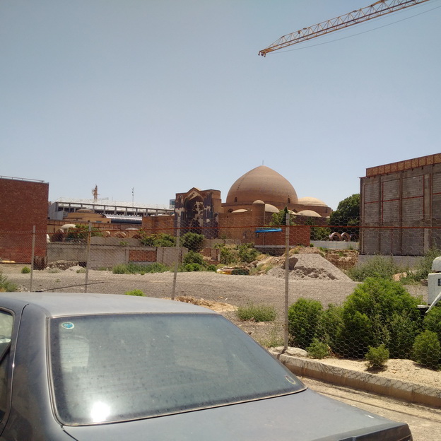
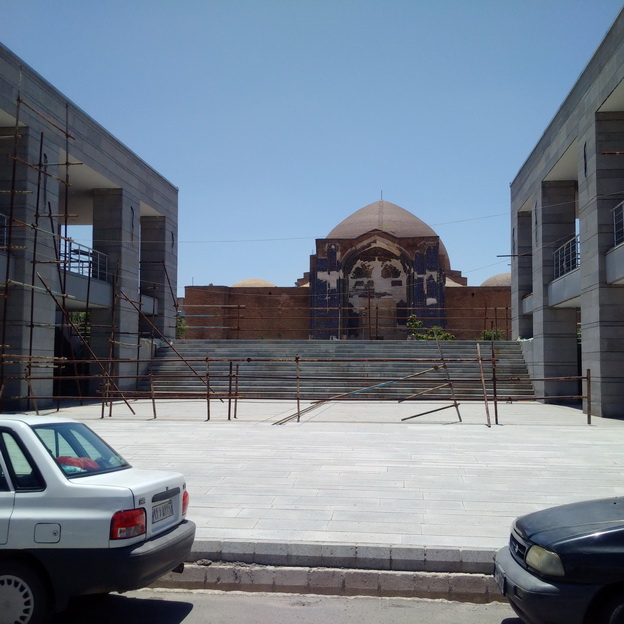
On that first NP morning in the square, an expansive and three-level plaza awaited us. At the lowest of the three levels, a pool almost the length of a football field jutted out from the police station. On the bigger second level, red-gravel paths divided four rectangular lawns, which were flanked by neatly trimmed bushes, two wide sidewalks leading toward the courthouse, and plenty of park benches. Up a long set of stairs to the third level, a triangular lawn revealed a statue of Mahatma Gandhi at its apex. His eyes, weary from marching, still determinedly fixed straight down Kilbourn Avenue towards the City Hall.

Other tribe members discovered that there were indeed more entrances to the square from Wells: a parking lot and crumbling staircase on the west side of the museum beckoned them, and the front of the courthouse allowed access as well. During later workouts, we would discover that the courthouse had closed the entrance/exit from the building as a safety precaution: “Absolutely no public access allowed.”

The sunrise revealed the square’s loneliness. The dried-up pond, the litter, the sleeping bags of homeless citizens. We all left our NP blood, sweat, and tears in MacArthur Square that morning, after long sprints, box jumps and leg throwdowns, but most of us – including myself – still knew nothing about why the square existed. Did anyone use the space during the daytime? Not necessarily for sprints like we did, but even just strolling or lunching, casual meetings, or relaxing games of frisbee?

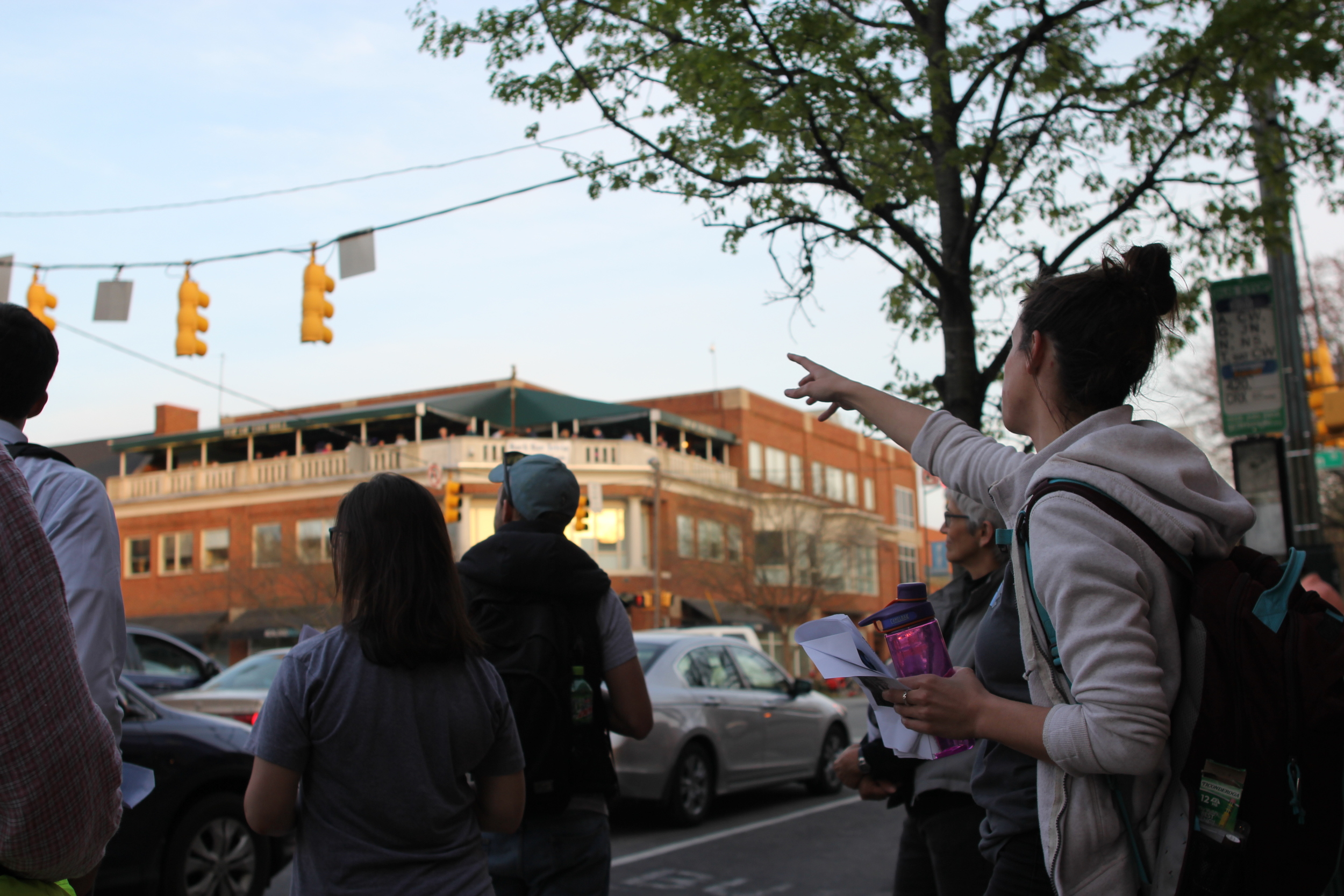
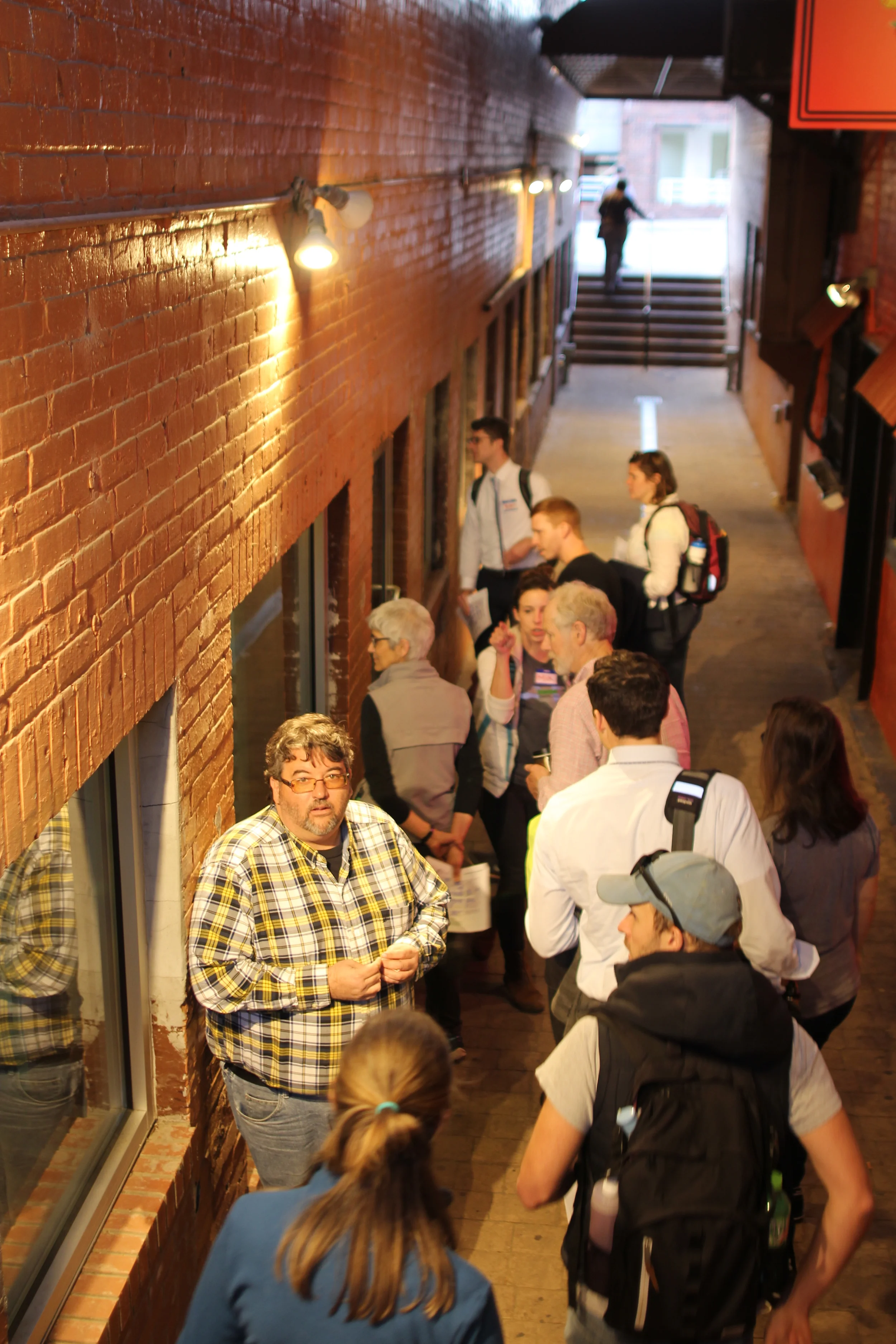
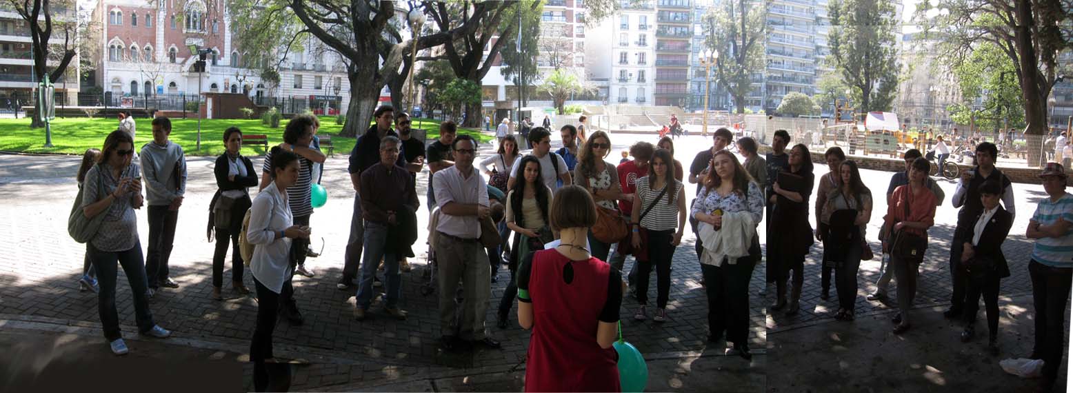
I would encounter MacArthur Square in a different way, and while wearing regular street clothes, months later. I led my first Jane’s Walk in 2017, called the Art & Justice Trail, that linked Bronzeville to Clarke Square via the James E. Groppi Unity Bridge. Among other sites along the way, the walk connected the statue of Martin Luther King Jr. in Bronzeville to the statue of Cesar Chavez in Clarke Square. At the halfway point was Gandhi, which most people on the tour had never seen.

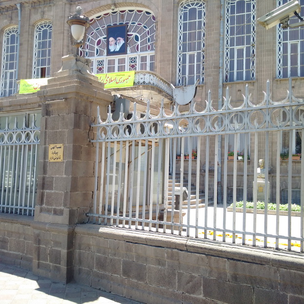
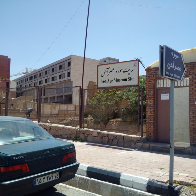
In 2002, the Indian American community erected the beautiful Gautam Pal statue on the site and named the small triangular lawn in front of the Courthouse “India-America Friendship Park.”

It was on this tour that I first introduced the walkers to what local historian John Gurda has called “the black hole of downtown Milwaukee… sucking the energy out of its surroundings.” He further bemoaned the square as an “oversized alley, owned by no one, used by no one, loved by no one.” Other than our group of tour participants, the square was empty.

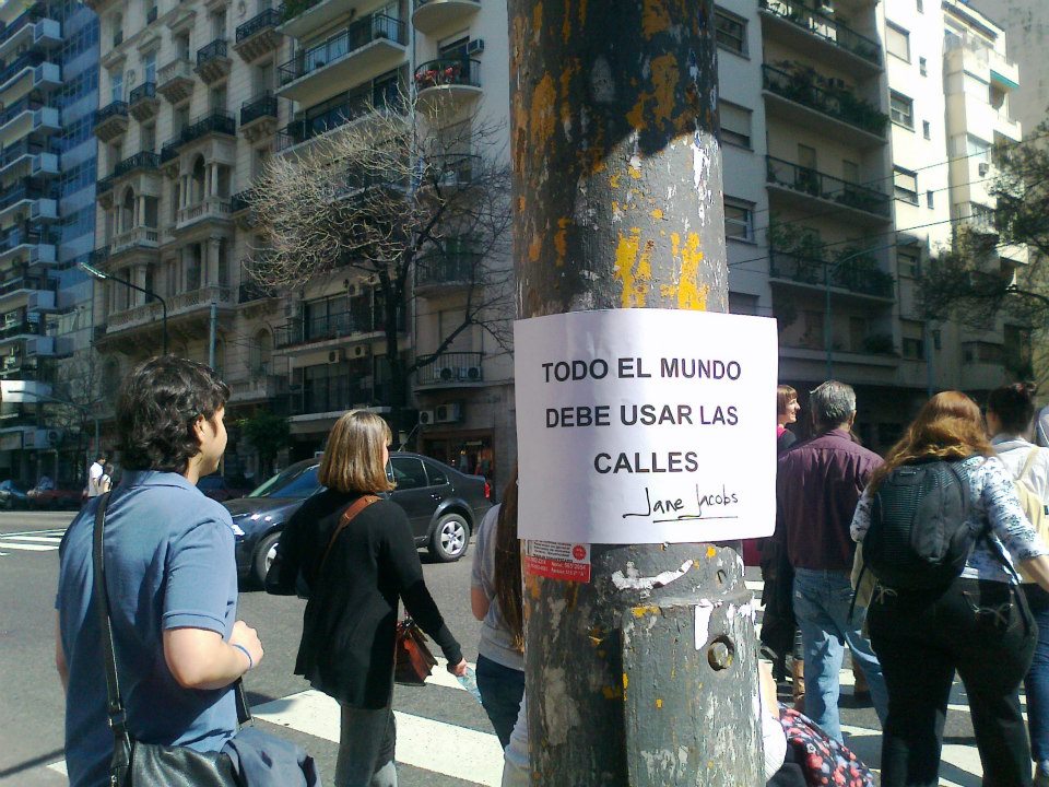
MacArthur Square was indeed what Jacobs had called an “island, in majestic isolation.”

Again, why had this happened? And what could be done to reactivate the space for public use?

When the Depression hit, no new civic center projects followed. After World War II ended, the city did name the plaza MacArthur Square to honor the general who called Milwaukee his “old hometown.” Six years later, General Douglas MacArthur himself visited the city with a great deal of pomp and circumstance. He concluded a thirty-two mile victory lap around Milwaukee with the official dedication ceremony of the square in his honor, witnessed by an attending crowd of 40,000 people.

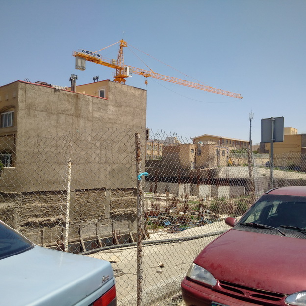
Then, the beginning of the end arrived. The 22.5-acre square became the roof of a 1,445-spot underground parking garage. The Milwaukee Public Museum on Wells Street blocked the square from view facing north, with the Safety Building blocking it from view on the State Street side. Then the Police Administration Building was erected. Neither the Schoenleber clock tower, nor the city Christmas tree, nor the statue of MacArthur finally erected in 1979 could attract more than occasional concerts or rallies to the square.

In 1990, the clock came down because it was deemed too expensive to maintain. In 2014, MacArthur’s statue was moved to the lakefront because the square had become what Gurda called “a dead zone.”

A recent excursion also revealed a modest monument I had never seen before, dedicated to Milwaukee police officers killed in the line of duty up until 1977. It sits unceremoniously near a desiccated pool amid benches, litter, and bushes with sleeping bags tucked behind them. Thirteen more officers have died in the line of duty since 1977.

We cannot forget the recent rallies and marches that began in the square, bringing thousands to the space to fight for women’s rights on January 20 and a couple hundred to fight for marijuana legalization on May 5. But the marches came and went. Today, the 22.5-acre park is as empty as ever, except for a some geese, other wildlife. A handful of homeless individuals, some pitching tents in the middle of the lawn, others curled up in sleeping bags in the low bushes or even against the police building, are the only people who frequent the space.

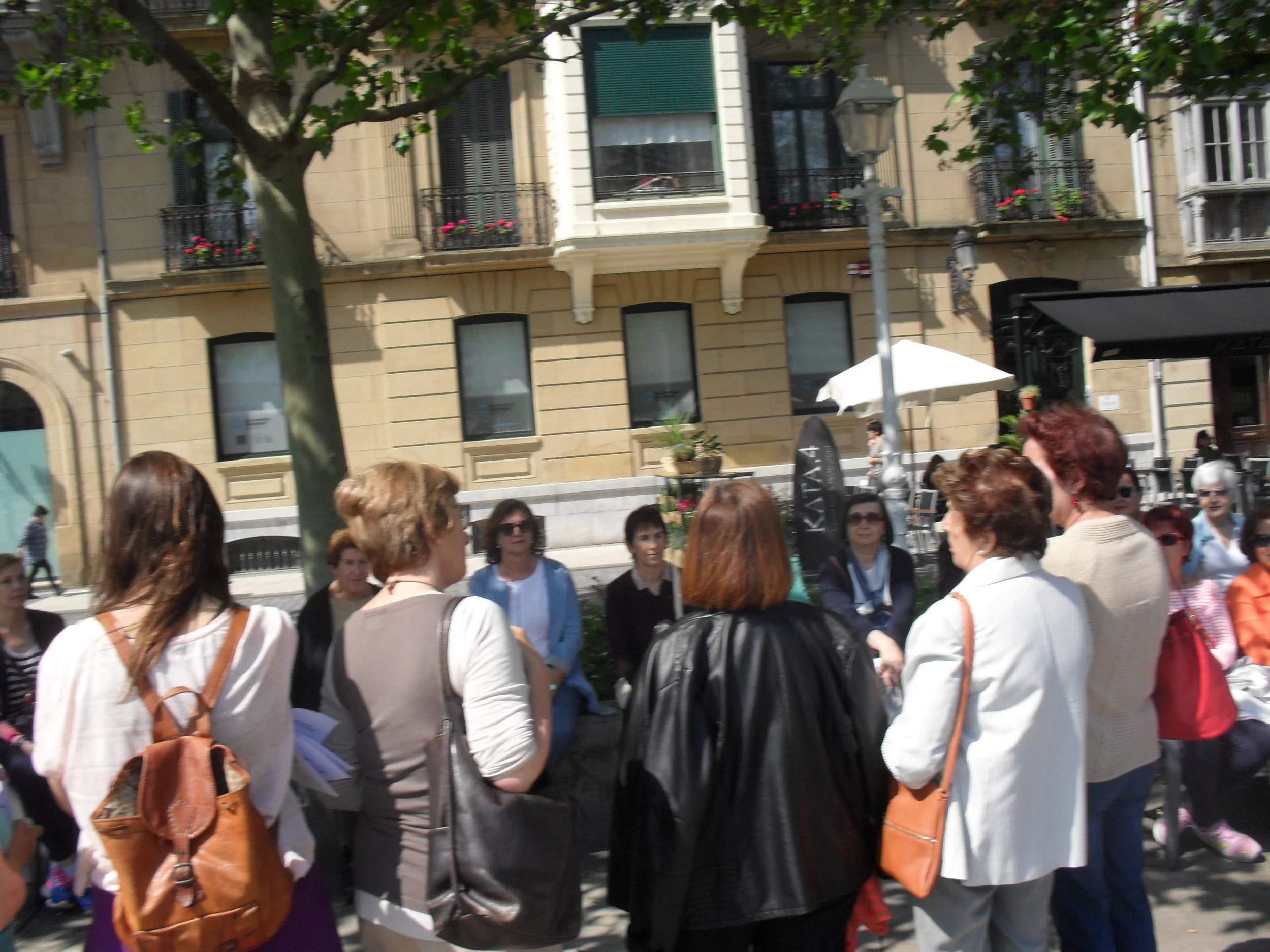
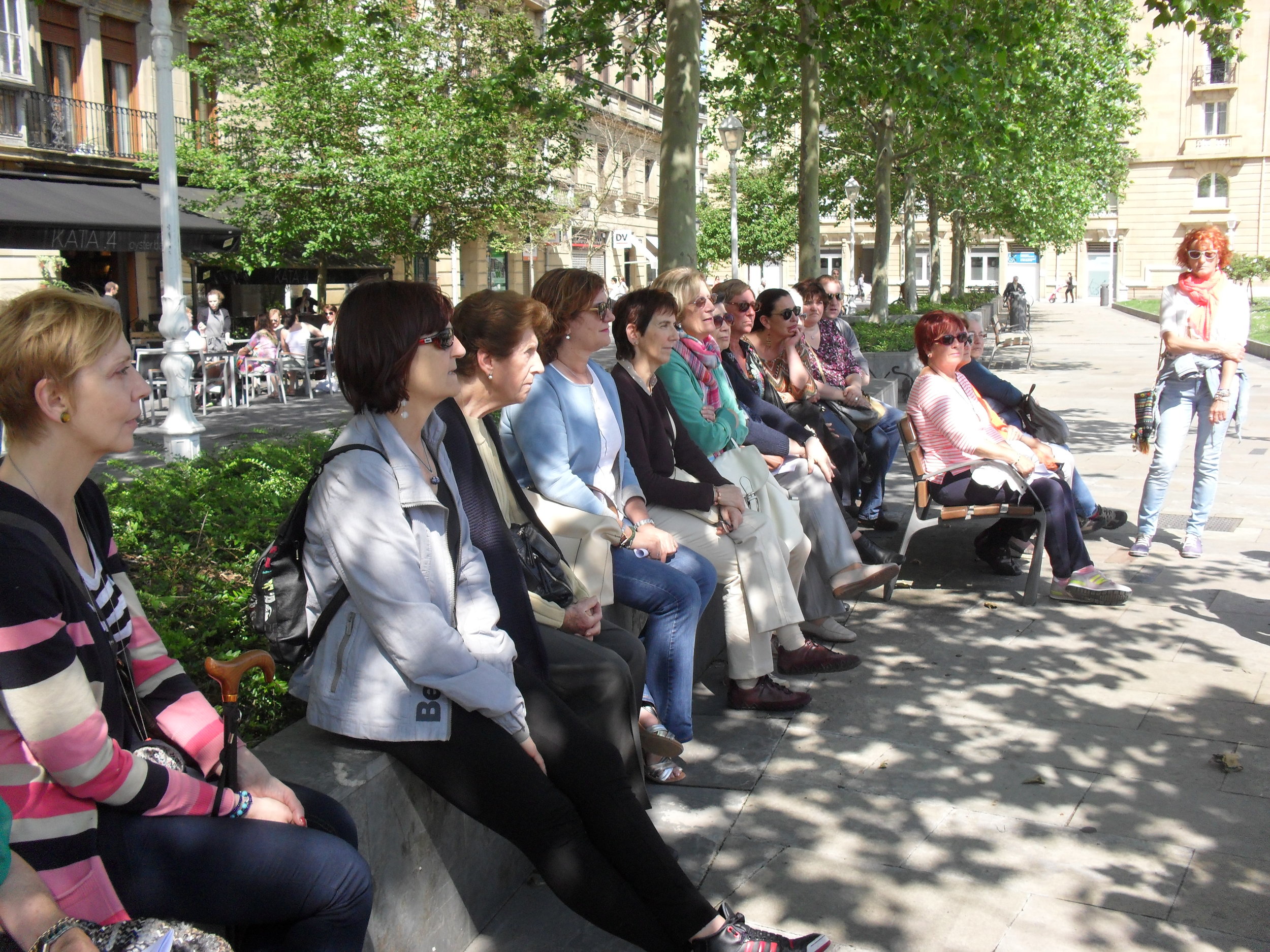
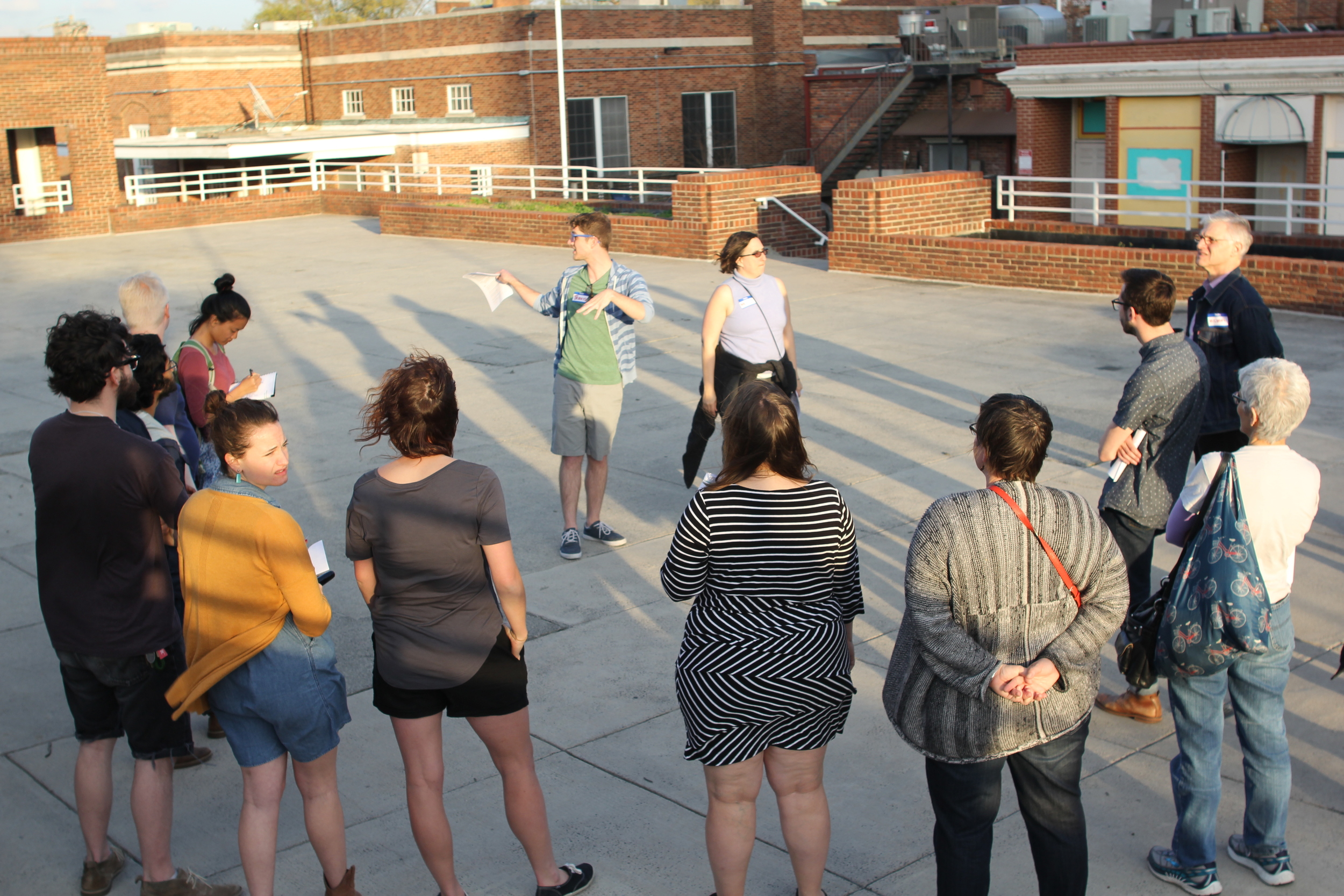
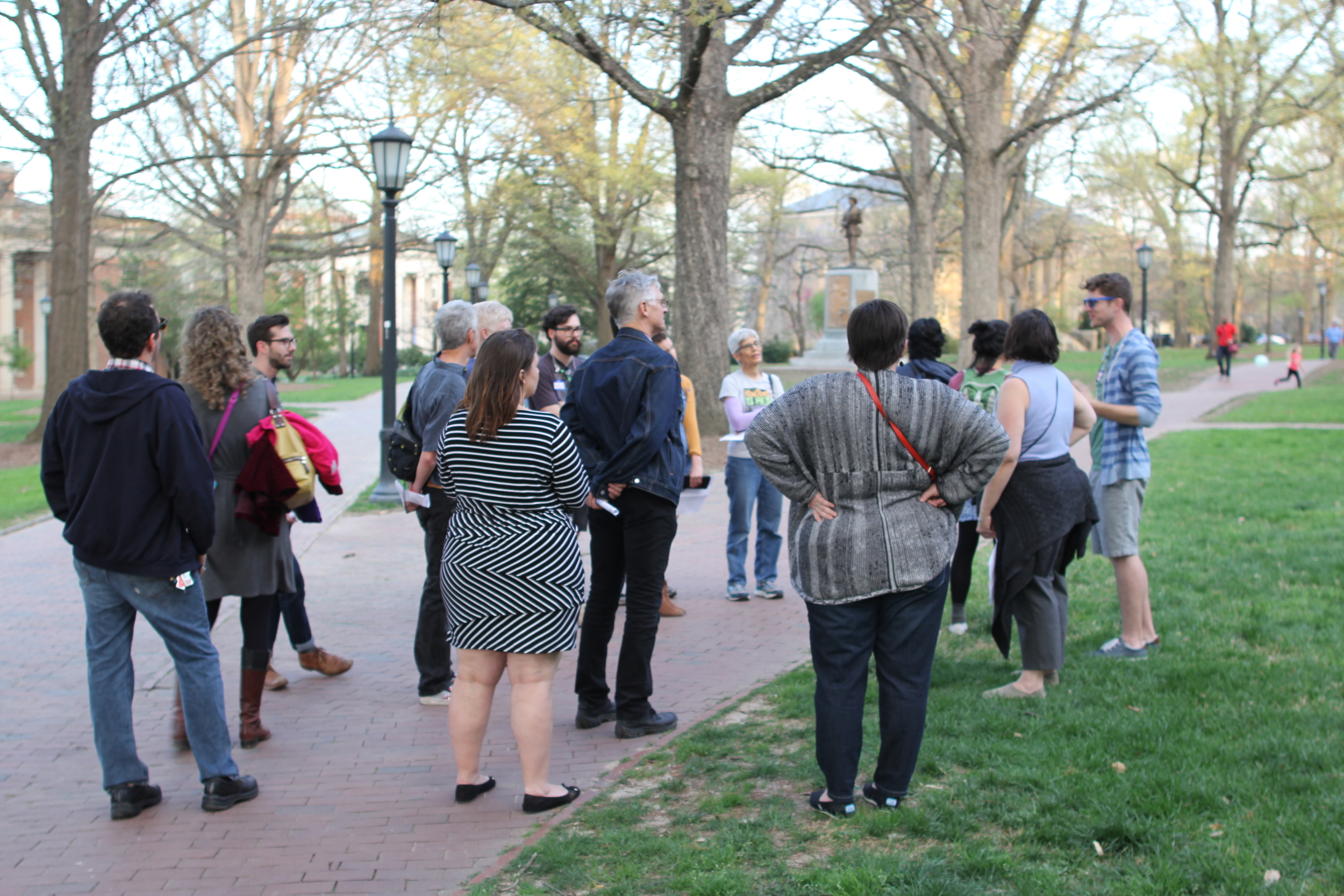
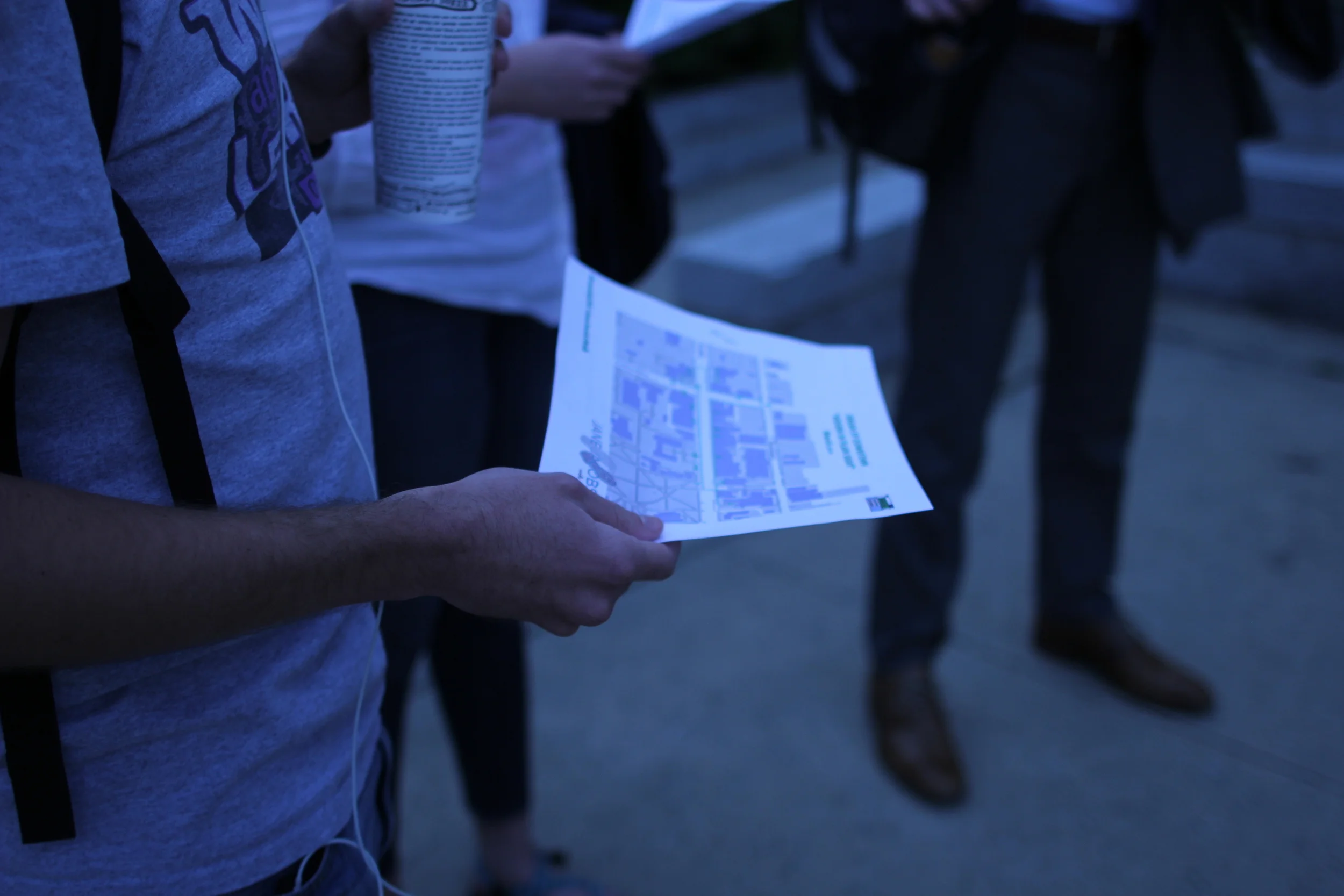
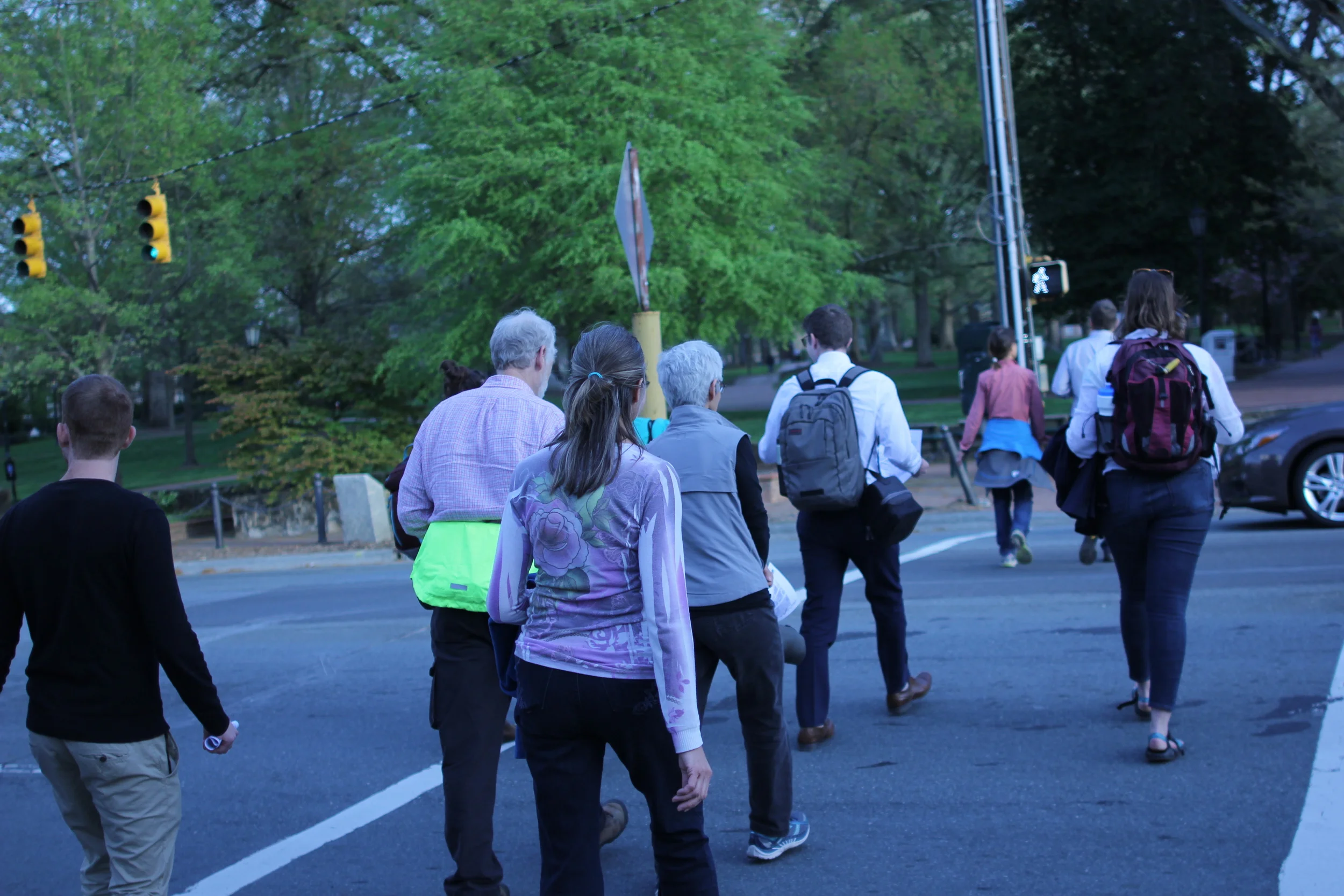
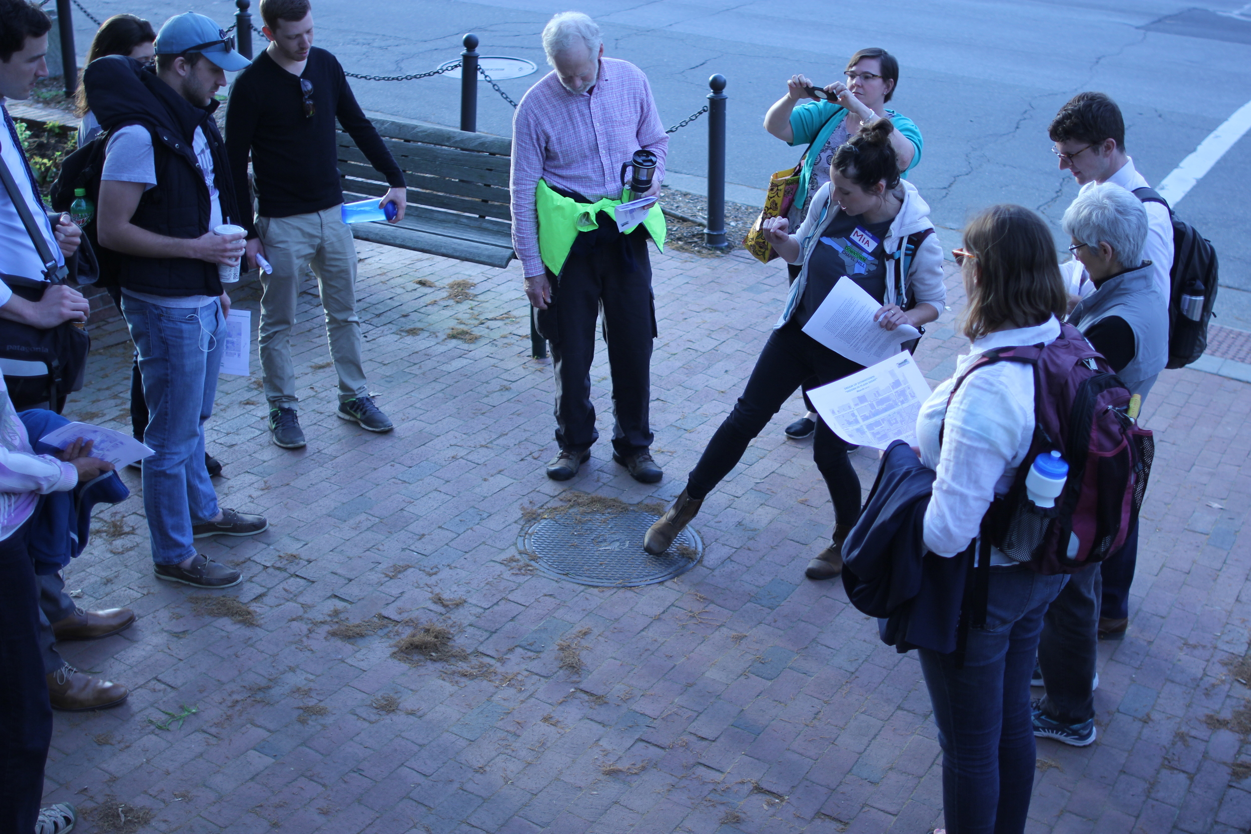
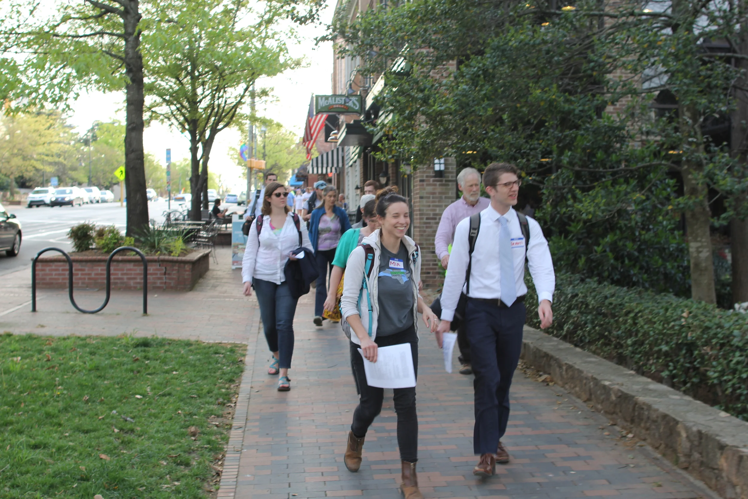
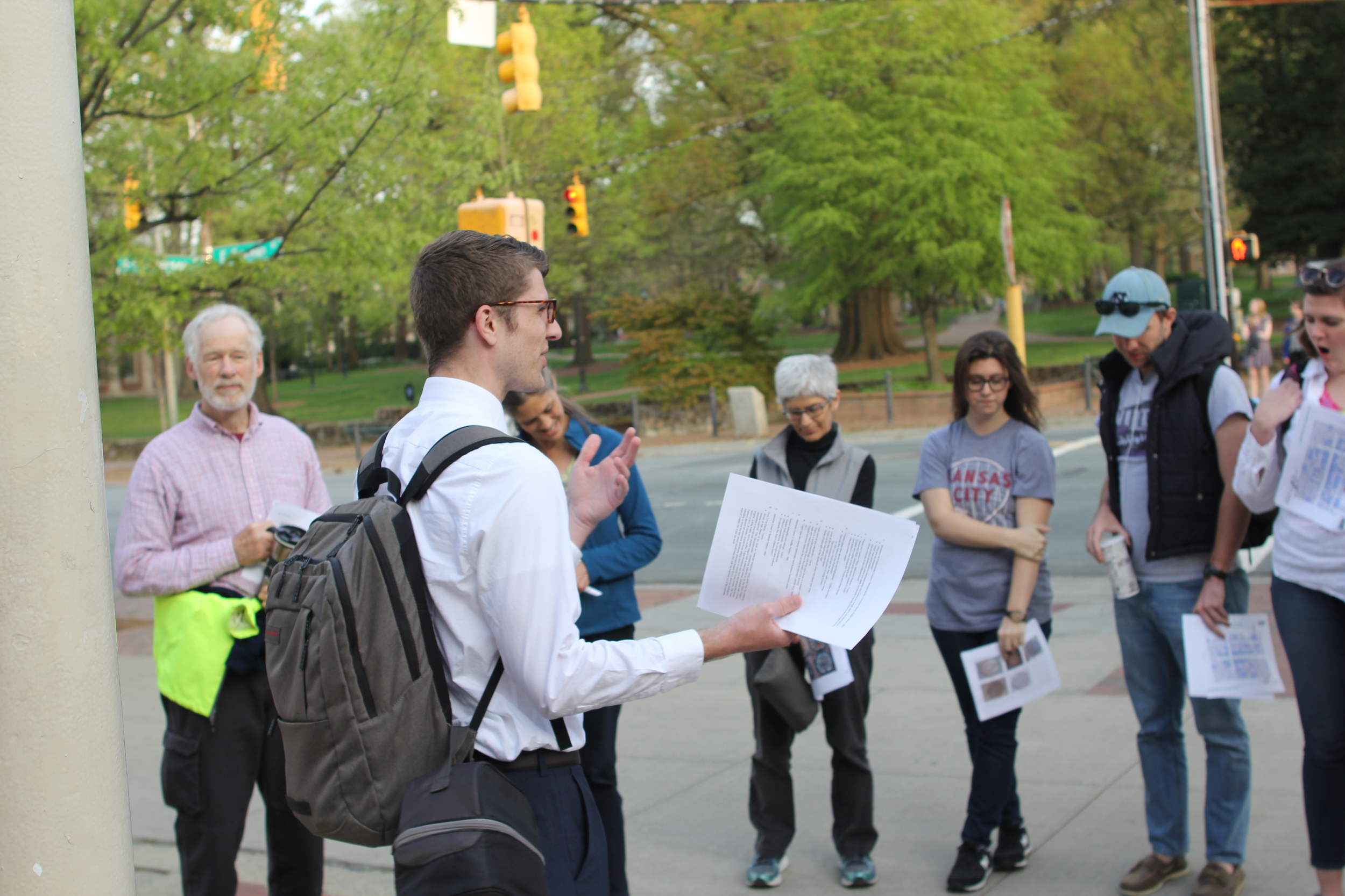
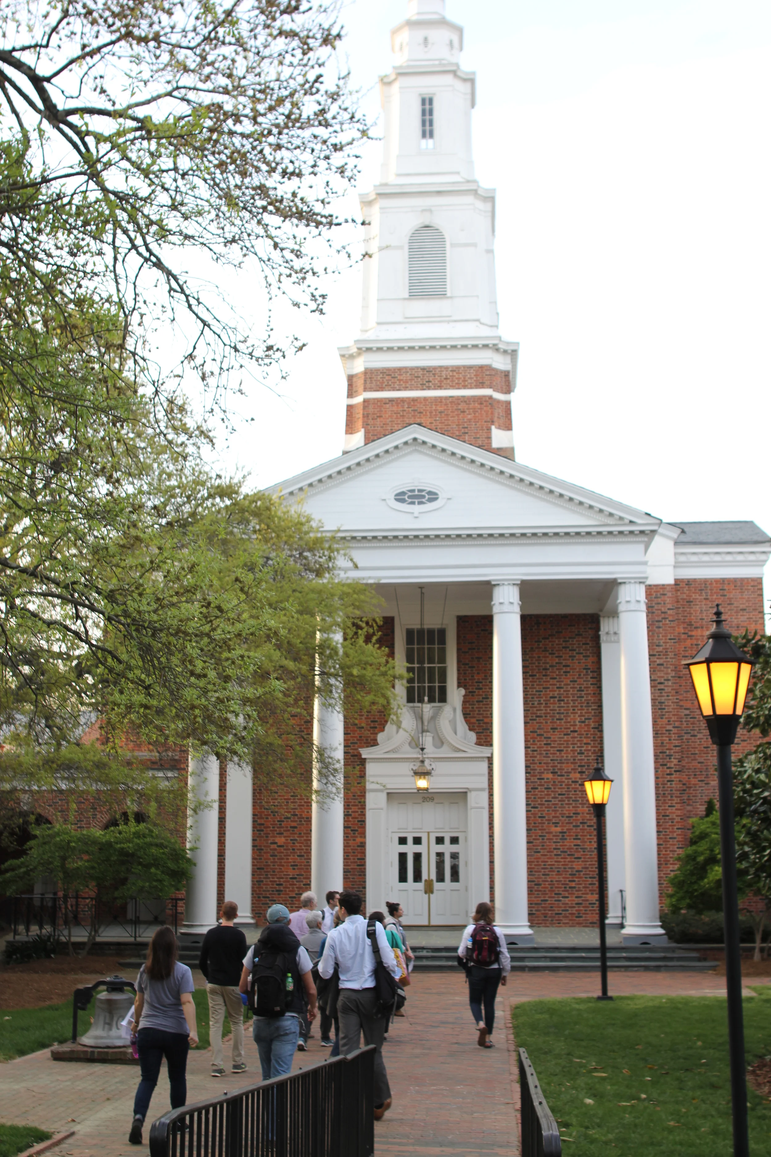
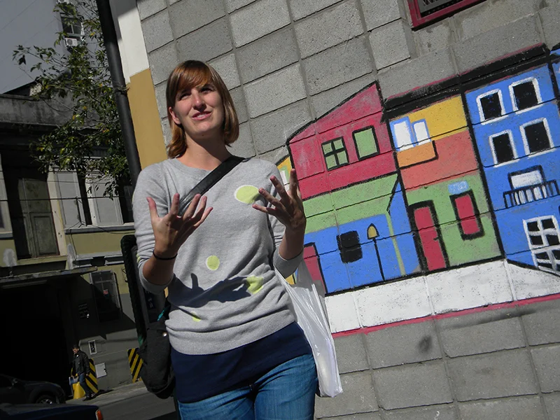
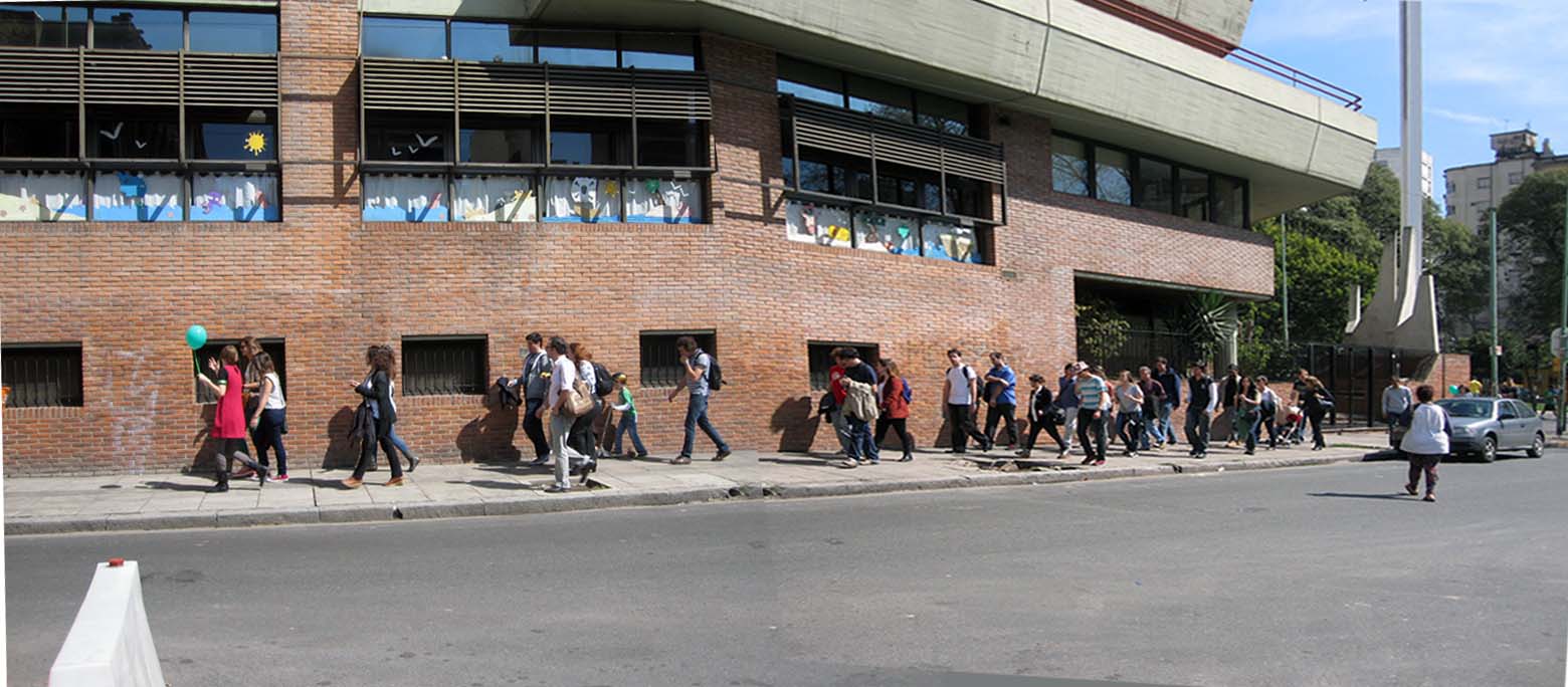
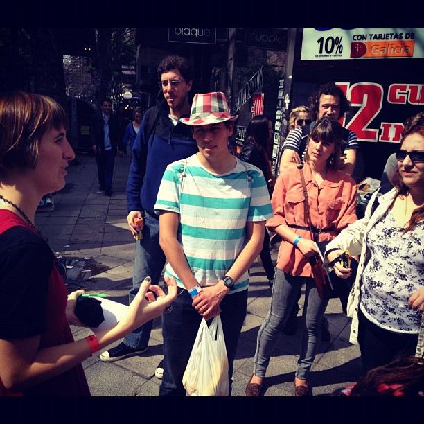
On a recent Saturday afternoon, as part of Jane’s Walk MKE, I offered residents a chance to help activate the space in a seemingly new way: learning some history, then play kickball and fly kites. I encouraged anything to use the space that was available to us. The weather forecast promised spring rains but had held back, and about a dozen brave souls took a chance to join me. We had time to entertain ourselves with various forms of recreation while we waited for everyone to arrive. But as my short history stroll around the square was coming to an end, a loud thunderclap shook above us – and the rain came. Huddling under some tree cover, we agreed to reschedule and before we left, we shared last-minute ideas for how to activate MacArthur Square.

To be fair, city officials in 2006 worked with Robert Greenstreet, architect and Dean of the University of Wisconsin-Milwaukee School of Architecture and Urban Planning (SARUP), who asked Larry Witzling of the Planning and Design Institute Inc. and a University of Wisconsin-Milwaukee School of Architecture and Urban Planning graduate student, Franz Heitzer, to consider ways to transform the space. Their two-day charrette resulted in a space with commercial development and various housing options, including condominiums and Milwaukee Area Technical College dormitories.

Among other things, the proposal called for two bridges to connect Kilbourn Avenue to the park, as well as other ways to better integrate the square to the street grid. The plan eventually proposed to the city in 2009 would have redefined the park space, reducing it by almost half. But the proposal’s hope of moving the entrance to the courthouse to the east side of the building would have highlighted its usefulness.

The grand dream of Clas was stalled many times and similarly, the Greenstreet plan was put on the back burner because of the Great Recession. However, according to Greenstreet in “Creating a Town-Gown Partnership: The Milwaukee Model,” “While economic uncertainty has stalled plans for repair and therefore major redevelopment of the square, the radical thinking in the plans will provide a provocative perspective on redevelopment that will shape planning decisions at the appropriate time.”

The article, published in the 2015 book SynergiCity: Reinventing the Postindustrial City, remains hopeful that in the future city officials will not ignore innovative possibilities for public spaces.

For now, Milwaukee County is still considering costly, piecemeal plans: demolishing the Safety Building and building a ten-story Criminal Justice Center, renovating the County Courthouse, repairing the leaking parking structure that also needs an improved HVAC system. It seems time again for a holistic development plan that considers the entire courthouse complex, including the museum, police structure, the street grid, and MacArthur Square.

Like Greenstreet, I remain hopeful but only because the drenched participants in the failed kickball event imagined possibilities outside the realm of development that would cost hundreds of millions of dollars. I have no doubt that MacArthur Square and its surrounding buildings will eventually be transformed somehow, for good or for ill. What to do with the space in the meantime, remains a question with few answers.

Some suggestions saw the possibility for outdoor movies and concerts. Other ideas involved food and beverage trucks. I have wondered lately if small festivals like Fringe Fest – currently held at Pere Marquette Park in August, MKE Festival of the Arts – also slated for August, or Oktoberfest could draw attention to the square. In fact, according to their website, local restaurateurs Craig Pruscha and Hans Weissgerber III are planning to move Milwaukee’s Oktoberfest from Pere Marquette Park to MacArthur in 2018, so this could be a start.

Someone else brought up the notion of using part of the square for a downtown dog park. While Claude Krawczyk and the Downtown Neighbors Association of Milwaukee, Inc. (DNA MKE), have been trying to persuade the Bucks to create a playground and dog park on the site of the soon-to-be-torn-down Bradley Center, gathering over 300 signatures so far on their petition, just two blocks west lies MacArthur Square waiting for someone to breathe life back into it.

The site is large enough to host a dog park, a people park, a children’s park, public art, a wading pool, and more. Especially in warm months, downtown dog owners would have a space to gather. Patrons and programs of local institutions could spill out onto the square to relax or learn. A splash pool and nearby playground equipment could provide an alternative to expensive water parks for residents in nearby neighborhoods.

The dreary backside of the museum could sport a massive Wisconsin-themed mural. Stair risers could be painted to resemble beloved book spines, a tribute to the library across the street, or justice-related quotations. Permanent and traveling sculptures could also punctuate the empty space as an offshoot of the Wisconsin Avenue project. A pay-as-you-can outdoor cafe near the monument to fallen officers could provide service to an assortment of visitors. The library across the street could host outdoor summer events in the square. And the Public Museum could also seek ways to use the square during their summer camps.

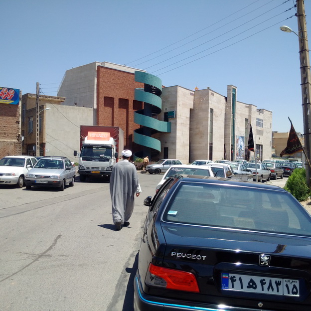
As for access, without having to build expensive pedestrian bridges from Kilbourn Avenue over 7th Street, the hidden spiral staircase could be spruced up. A new coat of paint in the same color could be used as a visual merger with the sidewalk, leading from Wells Street into the park.

I talked to someone recently who even suggested a socially conscious approach, by building tiny homes on the property for the homeless. That would probably require some rezoning. But imagine if a commitment to the city’s homeless stood, as tiny homes circling a community garden, under the shadow of the courthouse emblazoned with the words “Vox Populi, Vox Dei.” The square would become a square for the people, by the people.

MacArthur’s statue was relocated four years ago. So the space could be renamed to help its image. Calling it “The People’s Square,” for example, would appoint it as the place where people gather to have their voices heard. Citizens could make the square what they want it to be, when they want it to be. A mixed-use Milwaukee agora, like the ones in ancient Athens for commerce, arts and education, athletics – like kickball and kites. Political marches could begin at “The People’s Square” and commence toward City Hall, or vice versa. Imagine any kind of use for the people, by the people.

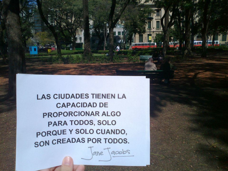
“Downtown has had the capability of providing something for everybody only because it has been created by everybody. So it should be in the future; planners and architects have a vital contribution to make, but the citizen has a more vital one. It is his city, after all; his job is not merely to sell plans made by others, it is to get into the thick of the planning job himself.” She insists that the citizen “does not have to be a planner or an architect, or arrogate their functions, to ask the right questions:

  • How can new buildings or projects capitalize on the city’s unique qualities?
  • How can the city tie in its old buildings with its new ones, so that each complements the other and reinforces the quality of continuity the city should have?
  • Can the new projects be tied into downtown streets?
  • Does new building exploit the strong qualities of the street—or virtually obliterate the street?
  • Will the new project mix all kinds of activities together, or does it mistakenly segregate them?

Let the citizens decide what end results they want, and they can adapt the rebuilding machinery to suit them. If new laws are needed, they can agitate to get them.”

– Jane Jacobs

Some of our ideas sound fantastical, some practical. Most of them will require some amounts of money. Some just require getting our collective butts into the square and using it in new ways, or urging the adjacent library and museum to consider innovative ways to activate it. The more MacArthur Square is used, the more it will become The People’s Square.

Jacobs expressed my feelings when she said, “What a wonderful challenge there is! Rarely before has the citizen had such a chance to reshape the city, and to make it the kind of city that he likes and that others will too. If this means leaving room for the incongruous, or the vulgar or the strange, that is part of the challenge, not the problem. Designing a dream city is easy; rebuilding a living one takes imagination.”

MacArthur 3.jpg

Why cities should be open—and unpredictable

MAY25_ALPHABET_DOHERTY-810x445.jpg

A great article by Mike Doherty discussing how cities should be designed to be adaptable and dynamic. This article is a repost from: https://www.macleans.ca/culture/books/why-cities-should-be-open-and-unpredictable/


There’s a remarkable photo of Jane Jacobs in Richard Sennett’s new book, Building and Dwelling: Ethics for the City, that’s captioned, in part: “In the White Horse Tavern in Greenwich Village, she chats happily with the author, unperturbed by the drunk who has passed out between us.” The late, legendary urbanist and the eminent cultural critic were likely debating urban planning—as they were wont to do—over the recumbent form at the bar. Although they often disagreed, both were devotees of what Sennett calls the “open city”: one that enables and encourages unpredictable encounters with strangers.

In Building and Dwelling, the Chicago-born Sennett rejects the kind of “frictionless” experience trumpeted by many high-tech companies. He contends that we grow as people and as a society when we have to figure out how to deal with obstacles of all kinds. In a closed city, he says, on the phone from his home in London, U.K., where he teaches at the London School of Economics, “everything is designed to function in a fixed way,” and so it’s not adaptable to change, whether in climate, the economy, demographics or simply the way people want to live their lives.

Sennett argues that not only planners and designers but everyone in general should embrace and nurture complexity. He practises what he preaches: Building and Dwelling draws on research from disciplines as diverse as phenomenology, literary theory, ecology and acoustics. It also follows Sennett’s work on craftsmanship in The Craftsman (2008) and Together (2012), completing a trilogy “about the skills people need to sustain everyday life.” And crucially, he also draws on his own experience of running a planning practice and consulting on development for the United Nations. In a wide-ranging conversation, he spoke with Maclean’s about why it’s so important, especially now, to be opening cities and opening minds.

Q: Is there a connection between your conception of open and closed cities and the open/closed axis that political pollsters are now swapping for the traditional left versus right?

A: There is, I think. Politically, we are entering a very dark period, in which certain enlightened, humane, open values—living with people who are different and so on—are being contested by the need for certainty and clarity, which means more exclusive and segregated communities. I wrote my book before Trump was elected, and I wish I had taken that on board: what’s happening in cities is part of what’s generally happening in modern society—people are running away from complexity. In Britain, people voted for Brexit because they didn’t want foreigners coming in, and a couple of months later, they realized, “My God, we’re very interdependent with the European Union, and we’ve done ourselves an incredible injury economically.” All of that gets lost in this kind of closed thinking—”If only we could purify ourselves of these complexities and make things simpler and control our own lives, we would be more secure.” It’s a childish regression from the reality of how modern society works.

Q: Related to this is the issue of figuring out ways to integrate, or include, refugees. What role could planners and designers have in these efforts?

A: This was the biggest urban challenge throughout the time I consulted for the UN. The problem of refugees is a very special problem of migration. Refugees who come from one urban setting into another tend to do much better. The trauma of displacement [for refugees from rural areas] is correlated with learning a new, urban way of life. We tried to deal with that by doing something very painful to everybody, which is trying to get people more integrated into communities where there weren’t so many of them and they were strangers. If they tried to reconstitute their villages in a foreign place, they would suffer—they wouldn’t know the language; they wouldn’t get ways of finding employer contacts, employee contacts, all of that. I’m interested in how you can get ripples in the pond of people who are able to wash into other communities—and gradually [how] people get a kind of compound or hybrid sense of who they are in the city. I think you can plan it by locating public resources at the edges of communities rather than at the centres.

Q: In the book, you take up the concept of being “indifferent to difference”—from Immanuel Kant via social critic Ash Amin—in other words, that people shouldn’t fixate on the differences between them, but accept that they exist. Should this attitude be more widespread?

A: I seem to be some cold-minded character. I don’t think the ultimate goal in life is to get closer and closer to other people [laughs]. I think human beings do well with a certain measure of respectful distance from others. As a social philosopher, I’m very suspicious about solidarity, which is very hard to separate from exclusion, and on a personal level, I would say there’s a kind of freedom in letting other people just be.

Q: You write about how Jane Jacobs “privileged what could be called neighbourliness without intimacy,” so it would seem you’re allying yourself with her.

A: Not really. I loved her, but Jane Jacobs really believed in community. It was a source of disagreement [between] us. I believed in cosmopolitan life, in spanning communities. When I started working for the UN, a lot of the nostrums in [Jacobs’s 1961 book] The Death and Life of Great American Cities seemed to me absolutely inapplicable to developing, emerging cities. She favoured slow growth from the bottom up, and when you have cities adding a million people every year, like Delhi, slow doesn’t begin to deal with their condition. You need top-down planning. She equated big designs with power brokers and tyrants. It’s a different set of vectors in the Third World or in emergent cities, where there’s a need to co-ordinate very complex physical relationships like water or electricity between communities. It’s particularly true in the places we were working, which had local solutions to local problems, but that meant that they were defective solutions like illegally tapping off of a grid to get electricity for a street—very dangerous as well as illegal. You can’t have a local sewer system. Particularly when she moved to Toronto, we had a lot of discussion about that.

Q: In Building and Dwelling, you write about “stupefying” versus “stimulating,” smart cities. Toronto is giving Google’s Sidewalk Labs 12 acres of the waterfront to develop, and there remains suspicion of their motives, particularly as their plans have been kept largely under wraps.

A: There are two ways to do smart city stuff: one is basically prescriptive, and the other is the “Linux” way, which is to use high tech and big data to give people a sense of choices that they can make. Linux is an open-source system of computation, and is employed practically, for instance, in collective budget-making in Brazil, in which you can collect a lot of data from voters to present them with ways of making decisions about how they want to spend municipal budgets. It looked to me from the material [I have seen about Toronto] that [Sidewalk Labs] is much more on the model of Masdar in the Emirates or Songdo in South Korea—smart cities in which everything is planned and calculated in advance and the citizens don’t really have much say about the rules that they’ll live under.

Q: In the book, you describe a model of “co-production” whereby people who will be living in areas that are being developed or redeveloped are given a direct say in its design. Can this apply even to a smart city?

A: We have to figure out the ways to make that happen, but I think you can have smart co-production with techies and non-techies co-operating. One I noticed in the bumf about Toronto was the idea of, “Get with the future!”—which is not a very co-operative way of looking at how to use technology. It’s closed-source thinking. In my version of co-production, you show people the pluses and minuses of different alternatives, as an expert, and then you leave the room. Once people have been given the information, they’ll see that there isn’t one single solution to any problem—certainly not in cities. They go through it and decide for themselves. We don’t want to repeat a classic problem in using consulting firms—they make a solution and they go away—in cities with high-tech. But I’m sure my model could be used where the [project deals with] information rather than physical structure.

Q: That would be a significant change, given the secrecy with which tech companies operate.

A: The secrecy is also concealment, because if they said, “We’re going to sell your trip behaviour every day to somebody who’s going to aim advertisements at you,” very few people would say, “Oh, I want to help you make money off of my behaviour for free.”

Q: In your writing, stretching back to The Culture of the New Capitalism in 2006, you prefigured the wave of craft-and-artisanal everything as an alternative to mass production. How do you feel about the way “craft” products and shops have been woven into gentrification?

A: Well [sigh], that is sad. The kinds of things I was beginning to see then, which are happening more and more, are a lot of new crafts emerging. New crafts in medicine and certainly in high tech are crafts in the way that people who were once leather markers were craftsmen: that shared knowledge. Craftsmanship is about making good-quality stuff, and we should be thinking about that problem and not be distracted by organic bread, which I agree, is a kind of luxury good for the gentrifying generation. I don’t think that’s really what craftsmanship is about. It’s [about] new kinds of technical knowledge that people can share, in which they want to do a good job of what they’re doing rather than just make crappy stuff. That’s a much bigger issue.

Q: In Building and Dwelling, you call sustainability a “builder’s buzzword.” Given your work with the UN, how do you feel about its Sustainable Development Goals, including one focused on “Sustainable Cities and Communities”?

A: I’ve argued that we should use the word “resilient” rather than “sustainable.” “Sustainable” is keeping an existing condition going, and [looking] at society and particularly cities as ideally homeostatic, even-keeled rhythmically, on course from minute to minute. “Resilience” means that stuff happens, and cities change, and the question is, when they’re dealt a body blow, how they can spring back, for instance after a storm or a drought? Given climate change, there’s no way you can prevent extremes of weather. Sea levels are going to rise. There’s no way to sustain what was there before, but there are techniques to recover and remake what’s there.

That ties into craftsmanship. A good craftsman is good at repair. He doesn’t junk things when they’re no longer usable for one particular purpose, and that same kind of craftsmanship is what we need in cities now. A well-crafted city can be repaired, and a poorly crafted city can’t be. I’ll give you a striking example: During a period when they thought they should only have one-child families, the Chinese built huge numbers of apartment buildings with very small flats inside. Now, the economy has improved, and the Chinese want to have two or even in some cases three-child families, and a lot of these flats are unusable for this dual purpose. A different way of building [them] would have allowed them to adapt. They built closed cities, and now they’re in agony about what to do. I’m interested in this question of, how can we build something that’s open enough that it’s adaptive or resilient, rather than something that completely serves a specified purpose? That’s my idea of the open city.


Interview with Jesse Feiler

Interview with Jesse Feiler

1. What is your relation to Jane Jacobs Walks?

I lived on Hudson Street in the West Village of New York, in the next block to Jane Jacobs. I joined the West Village Committee and was involved with projects such as stopping Westway and the de-mapping of the West Village. Jane describes the Hudson Street neighborhood very well in Death and Life of Great American Cities. The people I met through the West Village Committee and other groups were Jane’s friends and neighbors — a perfect example of how the experts on any community are the people who live there.

2. Why were you interested in hosting a walk in Plattsburgh?

One of the things I’ve learned over the years is that there’s nothing like walking to learn about a neighborhood. Plattsburgh is a small city — pop. 20,000, area 5 square miles, and remarkably flat so it’s amenable to walking. The city is centered on downtown which is an even smaller area extending from the shore of Lake Champlain to the campus of State University of New York College at Plattsburgh. The Saranac River runs through the City, and the multi-user Saranac River Trail was opened several years ago. With the second and third phases under way now, the City is as walking- and biking-friendly as possible.

3. What do you hope people gain from attending this walk?

We’re also just over an hour  on Amtrak to or from Montreal with frequent bus service to and fro so people can visit for the day or weekend without the need for a car. The City has a variety of people living here, and I hope they will meet one another. Also, this is an opportunity for people from the outside to find out who the people are who live in Plattsburgh.

4. What are your goals when you host a Jane Jacobs Walk for the participants?

We hope people will look at the place where we live and work and see it as if for the first time.

5. What are your hopes for the future of Plattsburgh with regards to Jane Jacobs Walks?

Friends of Saranac River Trail has been hosting walks (“Treks” we call them) for several years. We have focused on the Saranac River Trail, and themes such as nature (invasive species and birds) as well as activities (photo treks, stroller treks), and tour of remarkable places that are critically important that that people don’t pay attention to even though they see them every day. Our Water Pollution Control Plant (“sewer plant”) is like walking through a chemistry set, and it makes it possible for the magnificent Lake Champlain to host anglers and tournaments as well as marinas and one of the longest fresh-water beaches in the US. We’re repeating some of our treks but are adding Jane’s walks this year along with a sculpture walk.

Read More

The Economist: The World's Most Livable Cities

This is a repost of the article that was originally written in the Economist on August 18th, 2016. Written by THE DATA TEAM.

Original Article

COMING up with a list of the world’s best cities is a near-impossible task. The bustle and hum of megacities like São Paulo or Tokyo might be too much for some people; others might struggle with the pace of life in Cleveland or Frankfurt. A ranking released on August 18th by our corporate cousin, the Economist Intelligence Unit, attempts instead to quantify the world’s most “liveable” cities—that is, which locations around the world provide the best or the worst living conditions. The index, measured out of 100, considers 30 factors related to safety, health care, educational resources, infrastructure and the environment to calculate scores for 140 cities.


Damascus is the lowest-ranked city with a rating of just 30.2 out of 100, scoring poorly in all categories (understandably, due to Syria’s ruinous civil war). Kiev, the only European city in the bottom ten, performs better for health care and education but has a low stability score due to Ukraine’s ongoing conflict with Russia.Those that score best tend to be mid-sized cities in wealthier countries. Melbourne tops the list for the sixth year in a row (see chart, right), and six of the top ten cities are in Australia or Canada. But Sydney, Australia’s largest city, drops out of the top ten due to fears over terrorism.

Increased instability over the past year has caused a drop in the score of nearly a fifth of the 140 cities surveyed (see chart, below). Ten of these cities are in western Europe, notably Paris, which has suffered multiple terrorist attacks. Some American cities, including Atlanta, San Francisco and Chicago have also dropped down the rankings after spikes in civil unrest.

Photos Courtesy of: Getty Images, Reuters, Alamy, Getty Images, Alamy

Source: http://www.economist.com/blogs/graphicdetail/2016/08/daily-chart-14

Revisiting the First Princeton Jane Jacobs Walk

Revisiting the First Princeton Jane Jacobs Walk

"On Saturday, the first Princeton ‘Jane Jacobs Walk’ took place, honoring what would have been the 100th birthday of the famed urbanist. I’ve never been on a  Jane’s Walk before, so  it was a whole new thing. But it was great to get together with some local residents, and enjoy the great stuff that exists in our town. Although Princeton is a small town, there is much to discover, and in a group its even better because different people can point out different things that they know about. On this walk, we started from Small World Coffee East Nassau, at 254 Nassau St. Our group considered the nearby busy commercial area, much of which is zoned as ‘special services’ reflecting its history as a strip of automotive garages, gas stations and car dealers. (It is now a top dining destination in Princeton). The group was conflicted over the current plan to build a roof deck and screen in the front dining space at Blue Point Grill. Some people worry that it will take away what is currently a great informal outdoor community gathering space. Personally, I think it will be great, and I would like to see the new “Nina’s Waffle’s” open a similar outdoor dining area. This is what a Jane’s Walk is for: discussing what we like in the built environment, and thinking about what we would like to see more of."

Read More

Creative Placemaking in Leichhardt, Australia-An Interview with Simone Sheridan

I found out about the Jane Jacobs walk at an Urbanista Sydney meeting earlier this year. (Urbanista is a global, collaborative network amplifying the voice of women by supporting ideas, projects and actions that create positive change in our cities and communities.) At the time I was working with a place making organization, Place Partners, to coordinate a mural on a blank wall along with some other temporary space activation projects along one of Sydney’s most well-known streets—Oxford Street. I met other passionate women who were hosting their own walks and it inspired me to show off Parramatta Road and Norton Street, as I had noticed people saying a lot of generalized statements about both of those places since I moved there. I thought it was time to show off some my favorite places and local finds of the area while also using it as a chance to talk about some of the issues within the area relating to urban development.

Read More

Interview with Begoñia Pecharromán: Host of Jane Jacobs Walk in Donostia, Spain

1.    What is your relation to Jane Jacobs Walks?

We knew Jane Jacobs’ biography and her work, and we thought that she was a very interesting professional to learn from so we wanted to share her concepts and teachings with more women in Donostia-San Sebastian. In our group, Foro de las Mujeres y la Ciudad (Women and City Forum), we work in different lines to recognize women’s contribution to the cities and villages.

2.    Why were you interested in hosting a walk in Donostia, Spain, and what was the goal?

In Donostia there have been a few groups and associations that have hosted Jane Jacobs’s walks for the last two years. Our Forum hosted one last year in order to know the women’s contribution in Donostia. We wanted to carry on hosting the walks to pay special attention to subjects related to women that normally are hidden and veiled, but fundamental for people’s life in cities. We try to promote urban planning through the community participation. This is why we try to share Jane Jacobs’ life with more people—especially women.

3.    What is the contrast between women and women’s jobs in the 50’s compared to now in Spain?

We learned about jobs women did in Donostia at that time and we felt very privileged to have the women that lived in those years tell their personal story and share their testimonies.  There are a few differences. For instance, many jobs have disappeared because clothing manufacturers took over in our societies and we do mostly purchase clothes instead of making them by hand. Therefore dressmakers have no chance to work the way they did then. Fishing is also a way of earning an income that has almost disappeared, so the net menders have not been able to work. This shows a fundamental change. Another issue that we learned is that working conditions have changed for better, for people used to work very long hours for very low wages. On the other hand, benefits of working in the 50’s were that there were more jobs, and more chances of entering the workplace as an apprentice to learn the profession through experience.

4.    Do you have any stories from the walk, specifically with the women mentioned?

It was a great encounter to meet women of the different ages and share stories that showed how life was then. All of them could tell us many stories of how life was tough, but they showed solidarity throughout that time.

5.    What is Women and City Forum and what is your role there?

It is a group of women that have been working since 1996 to research, to reflect, and to share knowledge about the future cities, taking into account the women’s perspective and the human beings’ basic needs.  

6.    What are your hopes for the future of Donostia with regards to Jane Jacobs Walks?

We hope to organize one every year and have more and more people coming to the walks.

7.    What are your goals when you host a Jane Jacobs Walk for the participants?

We have three goals for our participants: to know Jane Jacobs trajectory, to promote activities to build and maintain the sense of community, and to recognize the women’s contribution in cities.

8.    Anything else you would like to add?

It would be good to know more groups that do Jane Jacobs walk around the world and share experiences.

Explanation about the forum in Spanish

Walk in Donostia

We want to give a huge thanks to Begoñia for doing this interview, as well as her contribution to Jane Jacobs Walks in Spain, Women and City Forum, and her community.

Interview With Afshin Edjlali-Host of Jane Jacobs Walks in Tabriz, Iran

Photo Courtesy of Afshin Edjlali

Photo Courtesy of Afshin Edjlali

1.    What is your relation to Jane Jacobs Walks?

I am a civil engineer, with M.Sc of structural engineering and I am working in "SUNGUN" copper mine as a civil engineer. I am interested in cultural discussions about my city and I am publishing a monthly magazine (attached to a newspaper) about construction industry. I was introduced to Jane Jacobs by one of my friends who is an architect. She knew that I am interested in walking in my city and in cultural topics.

2.    Why were you interested in hosting a walk in Tabriz?

There are some places all over the world that are known to all people and there is no need for more explanations, but in Iran and in my area (East azarbaijan province) the people should know and see more. I had a trip to Malaysia with my wife two and a half years ago and I went to the "BATU" cave, which is a very famous place in Malaysia. In Iran, the East Azarbaijan province is full of beautiful mountains and natural phenomena’s that no one knows around the world. I want to show those places to the world.

Photo Courtesy of Afshin Edjlali

Photo Courtesy of Afshin Edjlali

3.   Could you describe the walk in detail, as well as some of the photos and what they represent? 

Because of the international media, people think some strange things about Iran that just aren’t true. There are some difficulties. Women must be covered, and some habits are not accepted, but the life is going on in its normal way. The photos show that a normal stream of life is carrying on. But my goal for the walk was to show how the history of a region is being erased, and the photos are the best way to show that.

4.    What are your hopes for the future of Tabriz with regards to Jane Jacobs Walks?

When foreign tourists come to Iran they just travel to places like Isfahan and Shiraz. I wanted to say that there are more beautiful places to see, to walk, to enjoy.

5.    What are your goals when you host a Jane Jacobs Walk for the participants?

I want the walker to not only enjoy the walk, but also the architecture, the history, the delicious food, the climate, and the whole city.

6.    Anything else you would like to add?

I like walking around historical regions and I accept Jane's idea about relation between walking and soul of cities. Because of my job and my economical condition I cannot travel to many different countries, but I can invite people to share the joy of walking in Tabriz.

We want to give a huge thanks to Afshin for doing this interview, as well as his contribution to Jane Jacobs Walks in Iran.

If your interested in seeing the walk that Afshin did back in June, here is the link:

Walk in Tabriz

Interview With Ron Pesch—Longtime Host of Jane Jacobs Walks in Muskegon, Michigan

Ron Pesch.

Ron Pesch.

What is your relation to Jane Jacobs Walks?

Well I’m actually in IT for a living, and I do historical research as well. I started doing the walks around the neighborhood about 20 years ago through the International Buster Keaton Society. It was actually my son who introduced me to Jane Jacobs and her writings when he went off to college to study architecture and urban planning. So then I started reading her books, and when he showed me the Jane Jacobs Walk website, I started registering my walks. 


Can you explain your walk a little more? Who is Buster Keaton, what is the Actor’s Colony?

Buster Keaton was a silent film comedian in the early 1900’s. He got his start in entertainment as a young kid in the family vaudeville act. Then his father discovered Muskegon and decided he would move his family during vaudeville’s off-season, but he also saw an opportunity for real estate in Muskegon. It was the first place where Buster was actually able to be a kid and enjoy his summers. The Actor’s Colony they created there was his community—a place for them to create and test out acts. They would have a bunch of fun in the summer at Muskegon, going out on the water, testing out acts at a theatre. Then when winter came they would go back on the road doing acts all over the U.S. When Buster started doing movies in Hollywood he would go back to Muskegon and show his family around because, even though he wasn’t born there, Muskegon was the place he always considered his home. So on the walk I show people sites related to Keaton and the Actor’s Colony, including a historical marker and a street named after Keaton. We usually spend about two hours pointing out where everything used to be and showing people something they might not have known about their neighborhood. The amusement park and the old theatre are long gone, as well as Buster Keaton’s family cottage, but there’s still a lot of history to show people. There’s a baseball field where Buster Keaton fell in love with the game. During his Hollywood days, if he couldn’t come up with some material for a film, he and the crew would go out and play a game of baseball.


Is that your goal for the participants of the walk, that they will see something new and learn something about their neighborhood that they never knew before?

Yeah, my goal is to point out something that someone doesn’t normally see in his or her familiar surroundings, and give them tidbits of local history that a lot of people might not know. Then when the convention on Keaton comes around in October I get to show people from all around the world the neighborhood that they’ve read about in history books on Keaton.


What is your interest in Buster Keaton, how did you come to know so much about his past?

Well when I was a kid I never really watched any silent films. I occasionally saw the Three Stooges or a Charlie Chaplin movie, but I had only seen one film of Keaton’s called The General. Then someone told me that a silent actor grew up in Muskegon, and it turned out to be Keaton. When I got older I thought that was interesting so I started doing research on him. I started to become the local history expert on Keaton, and I found out his third wife was still alive and living in California. I was working for a company that had a lot of phone books at the time, so I got in touch with her, and ended up visiting her in California where she gave me photos and lots of information on Keaton. I’m always a firm believer to never be afraid to call or ask, because you never know where it might lead you.

By this time I was known around town as the local historian on Keaton, which is why a woman from New Jersey called me to tell me she was starting a Buster Keaton fan club, and when it got big enough she would like to have a convention in Muskegon every year, and she asked me if I would like to join, and I said sure. That’s when she said, “congratulations, you are now our 7th member.” Since then we’ve had 21 conventions and I’ve hosted around 45 walks. The 22nd convention is scheduled for this October.

Anything else you would like to add?

Just that Keaton is an inspiration to a whole host of people from Johnny Depp and Jackie Chan, to many of the folks at Pixar, and even though he was born in Kansas, he called Muskegon his home. I just love sharing that information with people, as well as checking out cities that I visit, and sharing Jane’s mission. In the summer I host about one walk a month, and it’s so important to get people outside and show them the value of walkability. 

Muskegon, MI: Buster Keaton and the Muskegon Actors' Colony


We want to give a huge thanks to Ron for his continued interest in Jane Jacobs Walk, and the contribution he has made to her mission as well as his community for many years in Muskegon. 

Jane Jacobs Walk Interview With Meredith Cherney of StayLocal

 The group shot - Top row (left to right): Abigail Sebton, StayLocal's Research and Policy Coordinator / Dana Eness Executive Director / Felice Lavergne, UC's Project Manager. Bottom row (left to right): Meredith Cherney, StayLocal's Program Manager…


The group shot - Top row (left to right): Abigail Sebton, StayLocal's Research and Policy Coordinator / Dana Eness Executive Director / Felice Lavergne, UC's Project Manager. Bottom row (left to right): Meredith Cherney, StayLocal's Program Manager / Anthony Rizzi, StayLocal Intern.

1.     What is your relation to Jane Jacobs Walks?

The organization I work with, StayLocal, supports New Orleans’ independent businesses. StayLocal is a non-profit founded in 2001 that promotes buying, sourcing, and supporting local. Our parent organization, the Urban Conservancy (UC), works to catalyze equitable policies and practices related to the urban built environment and the local economy through research, education, and advocacy. We thought it would be great to host a Jane Jacobs Walk together because her theories align with our work.

2.    Can you describe Stay Local a little more? How exactly do you promote local businesses?

StayLocal aims to raise the visibility and viability of the New Orleans’ local businesses. We do this through educating the public on the importance of shopping local and providing businesses with the resources they need to be successful.

We also advocate for independent businesses on the local and national levels to ensure policy represents the interests of small business owners. StayLocal conducts original research and publishes reports and studies that drive systematic change to support a vibrant local economy.

3.    Why were you interested in hosting a walk in New Orleans? 

Our walk focused on the “West Mag” economic corridor in Uptown New Orleans. We brought in local architect and neighborhood resident, Marilyn Feldmeier, to provide historical context and to give her perspective on what makes a successful economic corridor.

Marilyn told us that the corridor has always been an economic hub. Over the years, our transit modes played a major role in shaping the corridor. The Whole Foods on the block once housed mules when carriages were the main form of transit, and later it became a streetcar station as transportation modes evolved.

On our walk, we spoke to several local business owners including Blake Haney from Dirty Coast Press, a New Orleans themed retail shop, and Tom Lowenburg from Octavia Bookstore. Both owners provided a unique perspective on the corridor. Blake spoke about how the city’s distinct character inspires his work, and the effects of national chains in the corridor. Tom’s story focused on his policy work to level the playing field for brick and mortar retailers by ensuring fair and equal taxation of online goods.

In relation to Jane Jacob’s theories, the more we buy and source from businesses that are firmly rooted here in New Orleans, the more resilient we become.

4.    What are your hopes for the future of New Orleans’ community, maybe something related to the walk you did?

I hope that this city stays vibrant and diverse! Locally owned businesses imbue New Orleans with its unique character and aura of authenticity. They are a big part of why people want to live, work, eat, shop, and play here.

5.    What are your goals for the participants when you host a Jane Jacobs Walk?

I hope they gain perspective - that they think about something in a new way or see their city in a different light. Whether it is noticing a new store, learning about issues local business owners face, or identifying with the meaning behind Dirty Coast’s “Be a New Orleanian Wherever You Are” stickers, Jane Jacobs Walks encourage residents to appreciate the beauty and complexity of the places they call home.

6.    Anything else you would like to add?

I moved to New Orleans five years after Katrina, and there were few national chains. The chains were slow to re-build, but the local businesses were among the first to come back. Our independent businesses keep this city alive, keep it flourishing, and keep it unique! 

We want to give out a huge thanks to Meredith Cherney for doing this interview, as well as her contribution to Jane Jacobs walks, her service to her community, and the work she does at StayLocal.

If you want to learn more about subjects mentioned in this interview, here are some links:

New Orleans, LA: What Makes West Mag a Success

StayLocal.org

www.urbanconservancy.org/the-mission

Interview with Mia Candy-Host of the Jane Jacobs Walk series at Chapel Hill and Carrboro, North Carolina

Mia Candy


Tell me a little bit about yourself, how you came to know about Jane Jacobs Walks? 

I’m a recent graduate of UNC Chapel Hill, where I got my masters in City and Regional Planning. My work focuses on neighborhood planning, placemaking, and public space, particularly in low-income communities. I’m interested in dynamic community engagement techniques, including walking tours, which led me to run a series of Jane Jacobs Walks for my final graduate school masters project. The timing was also perfect as it was an opportunity to celebrate Jacobs’ 100th birthday.

Can you tell me a little bit more about the Walks you did at Chapel Hill?

I collaborated with the Chapel Hill Downtown Partnership to run a four part event series under the name Dream up Downtown. Two of the walks explored the public spaces in Chapel Hill and Carrboro, and the other two looked at the hidden elements of the built environment that give our cities a unique sense of place. The ‘hidden elements’ walks were inspired by the 99% Invisible Podcast. Local community members volunteered to help lead the walks, and in the end we had over 50 people participate in the event series. The walks garnered attention from the Mayor and other City officials, and as a result we ran an additional walk for City employees. We’ll also be running a couple more in the fall for incoming UNC students in the Planning and Public Administration programs.


Your walk focused on the small details of a city, and you mention the inspiration being the podcast 99 Percent Invisible, but was this also inspired by Jane Jacobs’ writings?

 Absolutely. Jane Jacobs’ texts and ideas are ubiquitous in the study of planning, but I was curious about how well her theories are implemented in contemporary planning practice. In re-reading her work, it struck me that she believed deeply in the organic nature of cities, and that chaos is often the source of vibrancy, dynamism and a unique sense of place. One of the results of this chaotic, organic growth is that cities are often characterized by relics of the development process – things like historic architecture; idiosyncratic street designs; and aging infrastructure that keeps a city running, but goes unnoticed day to day. These elements of the built environment are central to the 99PI podcast, and also to Jacobs’ love for urbanism, which is how I came to develop the theme for the walks.


What are your goals for the Chapel Hill community as well as the participants of these walks? 

 Events like these have the power to encourage increased interest in and engagement with the future of our downtown. My hope is that the spring 2016 series was the beginning of a conversation about what is and isn’t working about our local public spaces, and who exactly they’re designed for and used by. I’d like to see a movement towards public spaces that are more inclusive for all members of the Chapel Hill community. I’m developing a guidebook for local community members who would like to organize and host their own walks. The guidebook is similar to the one provided by the Jane Jacobs Walk organization, but focuses on the unique nature of the Chapel Hill Community. By creating this resource I hope to ensure that Jane Jacobs Walks can continue in Chapel Hill in perpetuity. 


Do you have any stories from your Jane Jacobs Walk?

 On the first day of the event series we ran one of the public space walks and two little girls attended with their parents. We were walking through an alleyway between two buildings, and it was pretty overgrown. We were discussing what works and doesn’t work about the alley, and how it could be improved. During the conversation I overheard one of the kids say that she liked the alleyway as it was, with all the overgrowth, because it makes the space interesting. It was a great moment for me because this kid probably had one of the most insightful observations on the walk, and had unintentionally captured Jacobs’ ideas about organic growth and chaos in cities. It was also fascinating to watch the way in which the kids found creative ways to use and play in spaces that would otherwise be considered dead or underutilized. It was an experience that taught me to pay closer attention to how children interact with space – they have natural instincts that say a lot about the potential of the place.


We want to give a huge thanks to Mia Candy for doing this interview with us, and for her continuing dedication to her community at Chapel Hill as well as Jane Jacobs Walks.

If you’re interested in some of the things mentioned in this blog post here are some links: 

http://www.janejacobswalk.org/search?q=chapel%20hill&f_collectionId=56ba31d52eeb81ff86614061

99PercentInvisible.org

Newtown Creek: Down Under the Pulaski Bridge Onramp-"Check out the composting toilet!"

May 2014: DUPBO, Down Under the Pulaski Bridge Onramp

On May 3rd, Mitch Waxman of the Newtown Creek Alliance led a Jane Jacobs Walk in Newtown Creek, exploring the Greenpoint and Hunters Point neighborhoods (you can learn more about this event here). This walk had a great turn-out and participants enjoyed the chance to explore these neighborhoods and share their observations.

Below, Mai Armstrong of Newtown Creek Alliance has provided an informative write-up about this Walk, and has shared some great photos.

Newtown Creek: DUPBO Down Under the Pulaski Bridge Overpass - May 3, 2014

Tour Leader: Mitch Waxman, Newtown Creek Alliance Historian.

We had 31 Jane's Walkers (plus 1 toddler in a stroller) attend on May 3, 2014 for the Newtown Creek: DUPBO Down Under the Pulaski Bridge Overpass Tour with Mitch Waxman. We also picked-up a couple of 'unofficial' attendees who tagged along for part of the walk.

The group was a nice mix of folks from the 5 boroughs, plus a few out-of-towners from California, Florida and Germany. Ex-residents of the 'hood mingled with new transplants as we walked from Greenpoint, Brooklyn to Long Island City in Queens. The walkers were enthralled the sights coupled with Mitch Waxman's narration as we wound our way through history.

As the tour visited the few public access points along both Brooklyn and Queens shores of the Newtown Creek, representatives from local organizations spoke to the group about their activities and advocacy for the troubled waterway.

Everyone had a great time, and thought the tour was interesting and exuberantly voiced their appreciation. 

Overheard on the DUPBO tour:

"I used to live here when I was a little girl... I don't recognize hardly anything anymore."

"Truck!!"

"It looks a lot like Miami."

"Check out the composting toilet!"

"We're working on re-greening the shoreline."

"Ten 30-story buildings? Are they going to put a new subway stop here too?"

"I'm gonna keep you alive, I promise!"

Write-ups: http://greenpointers.com/2014/05/06/newtown-creek-walking-tour/

http://harborlab.org/2014/05/04/janes-walk-to-our-reawakening-waterfront/